May, June storms bring higher Great Lake water levels for summer 2017
 Print
Print Email
EmailGreat Lake levels are up with Lake Ontario reaching an all-time high.
Have you seen the news on high lake levels on Lake Ontario? Lake Ontario reached all-time record highs in May 2017, resulting in significant coastal community, road, infrastructure and homeowner impacts. Currently the weekly Lake Ontario levels show Lake Ontario is about 30 inches higher than this time last year and 28” above the long term average in June. Colleagues with New York Sea Grant Extension are aiding in this crisis, using a scientific survey to determine impacts of the high water levels. The large rise can be attributed to very high precipitation on the basin, getting almost double the average precipitation as normal.
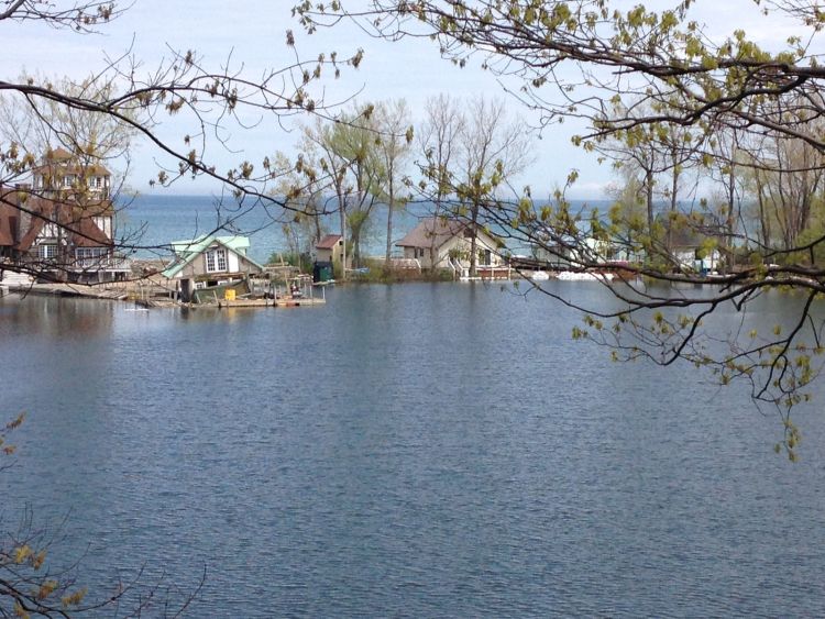
Back in Michigan, significant rain storms happened in late June 2017, particularly impacting the Saginaw Bay area. The United States Army Corps of Engineers estimates that Lakes Michigan-Huron rose a full 6 inches from April to May during the spring rise and had above average water supplies coming into the system. Lakes Michigan-Huron are forecast to be on the high side of average, about 15 inches above the long term average.
Lake Superior also rose about 6 inches during seasonal rise in May, being about 8 inches above the long term average and about 2” higher than in 2016. Precipitation and net basin supply was above average, with outflows above average through the St. Marys River.
Lake Erie is about 19” above its long term average and 9” above May 2016 levels and the most recent predictions are that it has reached the peak water level for 2017 and will decline about 3” over the next month.
As we head further into summer 2017, visitors to the beaches and boat launch ramps will notice these somewhat higher lake levels. Other great tools to check lake levels include the NOAA Great Lakes Environmental Research Laboratory’s online Great Lakes Water Level Dashboard.
It is amazing to think back of just about 5 years ago to the fall/winter of 2012/2013. Lake Michigan/Huron actually reached the record low level ever recorded in January 2013, in close to 100 years of accurate measurements. The strong rebound from these record lows is unprecedented in our history of measurements.
This summer season is well upon us and it will be interesting to see if levels follow the typical pattern of seasonal decline or if strong precipitation drives them further up. No matter what, be careful in all your water access – swim with flotation devices; be extra careful at launch ramps; and enjoy the dynamic coast of these freshwater seas.
Michigan Sea Grant helps to foster economic growth and protect Michigan’s coastal, Great Lakes resources through education, research and outreach. A collaborative effort of the University of Michigan and Michigan State University and its MSU Extension, Michigan Sea Grant is part of the NOAA-National Sea Grant network of 33 university-based programs.