MSU-WWF Carbon Monitoring Tool Adopted by UN Environment Program & International Organizations
 Print
Print Email
EmailAt a recent review meeting held in Tsavo, Kenya, the United Nations Environment Program and several affiliated international programs adopted a new forest and agriculture carbon monitoring tool that has been developed by Michigan State University.
At a recent major review meeting held in Tsavo, Kenya, the United Nations Environment Program and several affiliated international programs adopted a new forest and agriculture carbon monitoring tool that has been developed by Michigan State University (MSU), World Wildlife Fund (WWF), University of Maryland (UMd) and the World Agroforestry Center (ICRAF). The tool has been in development at Michigan State University’s Department of Forestry since 2009, and focuses on using ground and remote sensing based measurements of carbon stocks in forests, savannas, agro-forestry, and in agricultural landscapes with tree complexes outside of forests. The aim of these monitoring methods and tool is to better assess the carbon benefits of land-based development projects that are being funded through the Global Environment Facility (GEF) and several other multi-lateral development organizations. The Global Environment Facility (GEF), a leading global environmental public financial institution, was the major funder behind this innovative way to help mitigate climate change through a path breaking monitoring process designed to work in a variety of landscape settings—desert and forest, farmland and village. The independent review team endorsed the use of this innovative tool by the GEF and a range of its partner organizations, including the International Fund for Agricultural Development (IFAD), Food and Agriculture Organization (FAO) of the United Nations, and the International Center for Tropical Agriculture (CIAT).
The tool was developed by MSU, WWF, UMd, and ICRAF under the Carbon Benefits Project (CBP), and was implemented by the United Nations Environment Program (UNEP) as a new solution to a persistent problem: how to measure terrestrial carbon, particularly on complex landscapes. The CBP provides a cost effective system that integrates the latest remote sensing technology and analysis, ground based measurement, and rigorous statistical analysis.
“The CBP will save money and time by streamlining land cover analysis,” said Monique Barbut, CEO of the GEF. “Project managers that use the methodology will be able to engage communities in measurement efforts and help them benchmark for better results.”
Specific benefits of the CBP include:
- Measuring terrestrial carbon on a large area basis even in heterogeneous landscapes with many landcover types such as those that include smallholders in developing countries.
- Building a cost effective and accurate system that provides a way to document the mitigation of atmospheric carbon levels as a global environmental public good. The system will be applicable across the full portfolio of land use projects implemented by the 10 GEF Agencies (World Bank, Regional Development Banks, IFAD, UNDP, UNIDO, FAO and UNEP) and thus provides a way to compare and document their performance in contributing to climate change mitigation.
- Encouraging sustainable development projects that generate climate adaptation, mitigation and conservation benefits, thus making projects that include a carbon component more attractive.
- Assisting land use carbon project developers in selecting methods that combine livelihood benefits with climate change mitigation benefits.
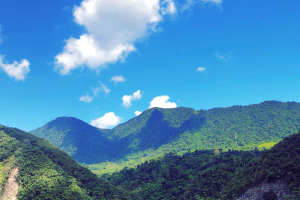
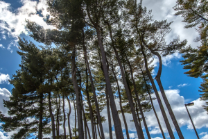
The meeting also included a field excursion and training exercise organized by MSU Forestry scientists for the review participants. The field training was conducted at the Wildlife Works’ Rukinga Sanctuary Project in Kenya, a partner organization with MSU in the southeastern Kenyan savannas, which has established a 20,000 hectare landscape restoration and community development project to protect wildlife habitat and enhance the livelihoods of the local communities. Review members were provided a first-hand look at how the ground forest carbon inventory is made and coupled to remote sensing mapping using demonstrations on-site at the Wildlife Works project site. The Wildlife Works forest and habitat restoration project is part of a large effort to restore the Mount Kasigau corridor between Tsavo East and Tsavo West National Parks in Kenya, and is the site of Africa’s first approved and financed carbon trading transaction for a Reduced Emissions from Deforestation and Degradation (REDD) project.
“This is a great demonstration of linking carbon benefits to both climate mitigation and rural community development”, says Jay Samek, MSU Forestry Research Scientist on the project. “One of the critical missing pieces in linking the large international development organizations to small holder poor rural farmers in climate mitigation is the lack of measurement tools suited to both types of users."
“By developing on-line systems to organize forest and agricultural inventories, remote sensing mapping, and carbon emissions computations both the donor organizations and the community-based organizations on-the-ground can work with and share equally the same data and information. This enables them to become closer working partners with better environmental and development outcome,” adds Mike Smalligan, the MSU Research Forester on the project.