Drone debate trickles into the field of water science
 Print
Print Email
EmailWater sampling drones bring big advantages and big complications to the world of aquatic research.

Over the past decade the prevalence and sophistication of Unmanned Arial Vehicles (UAVs) has grown enormously. UAVs, commonly referred to as drones, have no onboard human operator but rather their flight is directed using remote controls or autonomously through a computer. A favorite topic of public debate, the use of drones has expanded across a variety of sectors. It seems that everyone from Hollywood producers to cattle ranchers are exploring new applications for these machines. Researchers studying water quality have developed their own innovative take on the drone trend.
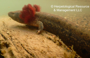
Around the country, several different research programs have developed UAVs equipped to collect water samples. The drones take on all different sizes and models. Some hover above the water surface and use a long straw like tube to suck up a sample. Another model acts like a miniature seaplane outfitted with pumps that draw in water as it lands. Saginaw Valley State University students have even developed a water sampling drone equipped with a drill attachment that bores through ice for winter sampling.
Traditional water sampling methods rely heavily on researchers or volunteers traveling long distances to collect samples at multiple test sites. It can be time consuming and very costly. UAVs offer a faster and more efficient collection option able to cover large areas rapidly. Because UAVs can operate based on Global Positioning System (GPS) coordinates, their accuracy and consistency is much better than the average human sampler. They can be programed to sample at precisely the same GPS coordinates every time. UAVs are also capable of reaching locations not accessible or safe for humans such as sites overgrown with vegetation or with high levels of contamination. David Karpovich, director of the Saginaw Bay Environmental Science Institute at Saginaw Valley State University, explains, “The use of drones for collecting water samples will allow us to study locations that are otherwise inaccessible due to time, safety, or geography. That essentially gives us the ability to gather more information, which is always beneficial.”
Along with these advantages, UAVs also come with a host of serious privacy and security concerns. The Federal Aviation Administration (FAA) has struggled to develop regulations that keep pace with rising commercial interest in UAV use and rapidly evolving technology. Currently only hobbyists may operate UAVs without a permit and they must remain below 400 feet of elevation and within the operator’s visual line of sight. Research programs at public universities may apply for a special certificate to operate UAVs in a specific area but this process requires a great deal of time and red tape.
As it stands, regulatory restrictions and delays are the largest barrier for researchers seeking to incorporate UAV technology in their investigations. With new policy changes on the horizon we may soon see water samples collected not by harried graduate students but instead by high-tech drones.