New paper: Ecosystem service dynamics in the Lower Omo
 Print
Print Email
EmailOTuRN affiliates have published a new paper from the SIDERA project: Integrating Participatory Methods and Remote Sensing to Enhance Understanding of Ecosystem Service Dynamics Across Scales
OTuRN affiliates Jenny Hodbod, Emma Tebbs, Kris Chan, and Shubhechchha Sharma have published a new paper: Integrating Participatory Methods and Remote Sensing to Enhance Understanding of Ecosystem Service Dynamics Across Scales.
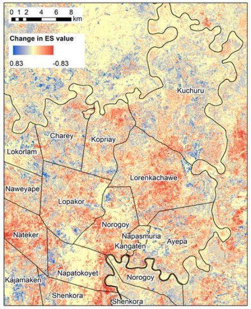
This focuses on the ecosystem service dynamics in the Nyangatom woreda and Lower Omo, integrating traditional ecological knowledge from Nyangatom communities into remote sensing analyses. The paper shows that the the collapse of flood-retreat agriculture has been compounded by degradation of shrubland and wetland that provide the ecosystem services people now depend on even more. The below figure shows that generally, ecosystem services values have decreased across the region:

Map of change in provisioning Ecosystem Service (ES) value (metrics derived from participatory mapping) between the periods 2000–2003 and 2016–2019 for kebeles in Nyangatom, South Omo Zone, Ethiopia. The right-hand panel of Figure 6 was recreated for 2000–2003, and this figure shows the change over time for ES value.
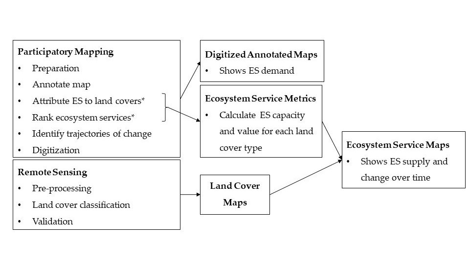
Additionally, this paper has a methodological contribution to mapping ecosystem services. We provide a new approach for incorporating traditional ecological knowledge elicited via participatory methods into landscape-scale remote sensing analyses: