Southwest Michigan field crops update – May 27, 2021
Rainfall this week is coming at a crucial time to get herbicides watered in and crops out of the ground and off to a good start as planting is nearing completion.
Weather
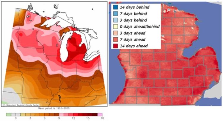
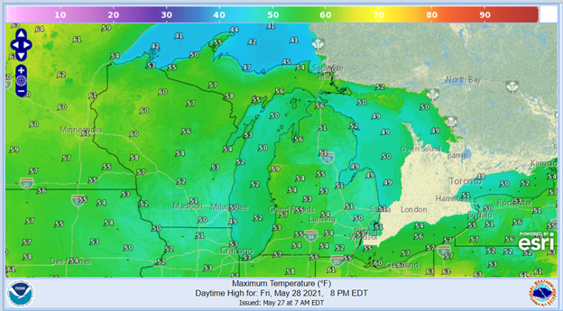
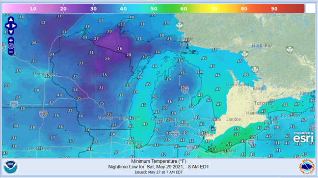
May has been an interesting month with temperatures 12-plus degrees Fahrenheit below normal during the first week to 12-plus F above normal this past week. Growing degree days (GDD) are now tracking above normal again by about a week, and that should remain the same over the coming week. A Canadian-origin high pressure system will be associated with the cold front coming through Michigan over the next couple of days with possible frost further north in the state on Saturday morning but not likely in our area. Temperatures will moderate over the weekend and return to normal by Memorial Day, May 31.
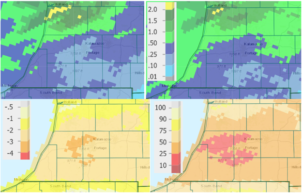
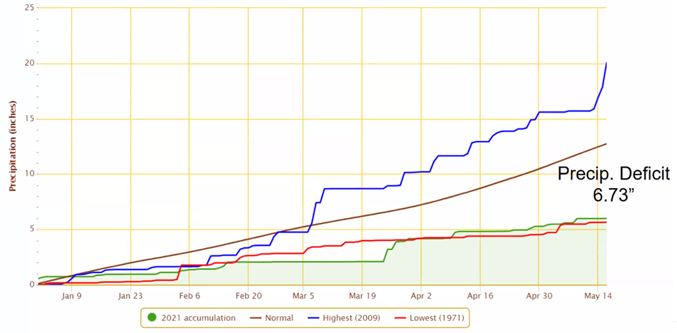
The main story continues to be precipitation, or the lack of it. According to the May 24 USDA Crop Report, 62% of the state is short to very short in topsoil moisture, and the high temperatures and breezy conditions this past week strengthened that. Though we did pick up 0.4 inches of rain on average across south central and southwest Michigan earlier this week (higher amounts closer to Grand Rapids, Michigan), most areas have received 10-50% of normal rainfall over the past month.
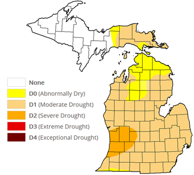
As an example of the dry trend, MSU agriculture climatologist Jeff Andresen has calculated the accumulated precipitation in Coldwater, Michigan, as of May 16—we were very close to setting records for low precipitation, let’s see how rains this week affect this. The current version of the U.S. Drought Monitor is largely unchanged from last week, although Andresen tells us there is a considerable lag with regards to taking rainfall into consideration, so it will be interesting to see next week’s assessment. Aside from a brief time in August 2018, this is the first time since 2012 that we have seen D2 drought conditions here in Michigan.
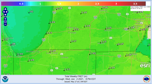
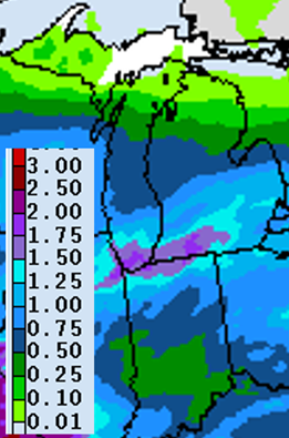
With below-normal to normal temperatures this coming week, the weekly forecasted reference evapotranspiration (FRET) is just under 1.2 inches for the region. The precipitation forecast for the coming week is favorable, and most areas in the region should receive between 0.75 and 2.0 inches, essentially all that falling Thursday night to Saturday morning with little chance of rain again until late next week. The 8-14 day outlook calls for above-normal temperatures and, though the current prediction is for slight chances of above-normal precipitation, Andresen suggests we take that with a grain of salt in this case.

Crops and pests
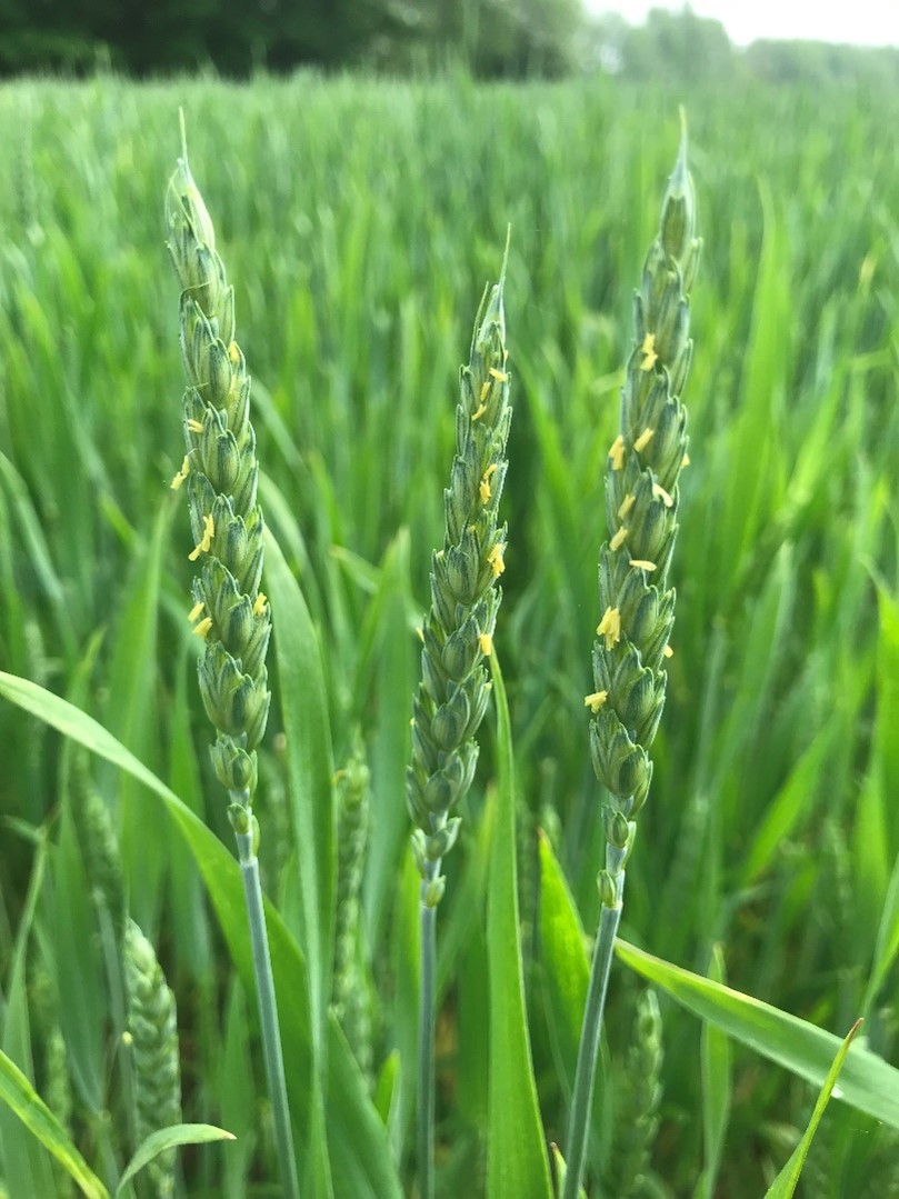
Wheat was at the heading stage (Feekes 10.5, head fully emerged) in our area earlier this week, although one field visited had already begun flowering (10.5.1) by Monday. The yellow flowers will begin to appear in the middle of the head and progress upward and then down toward the base. This stage begins the optimum time for a fungicide application for head scab (also known as Fusarium head blight) if warranted.
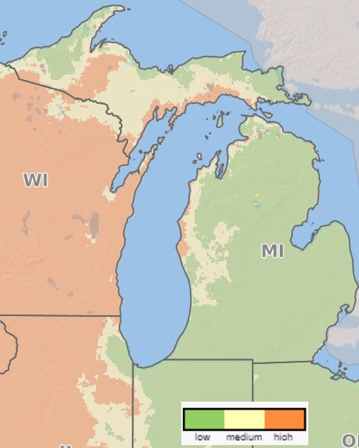
The risk for head scab is currently low for southern Michigan, even for susceptible varieties. MSU field crops pathologist Marty Chilvers says that if you have never had an issue with head scab in your fields with a given variety, you should be OK not making the fungicide application at flowering this year. However, if the risk level increases over the next one to two weeks, or if you have switched to a variety this year that is more susceptible than you have used in previous years, or if you typically spray for foliar diseases that can be controlled with an application at flowering, then he would recommend making that application.
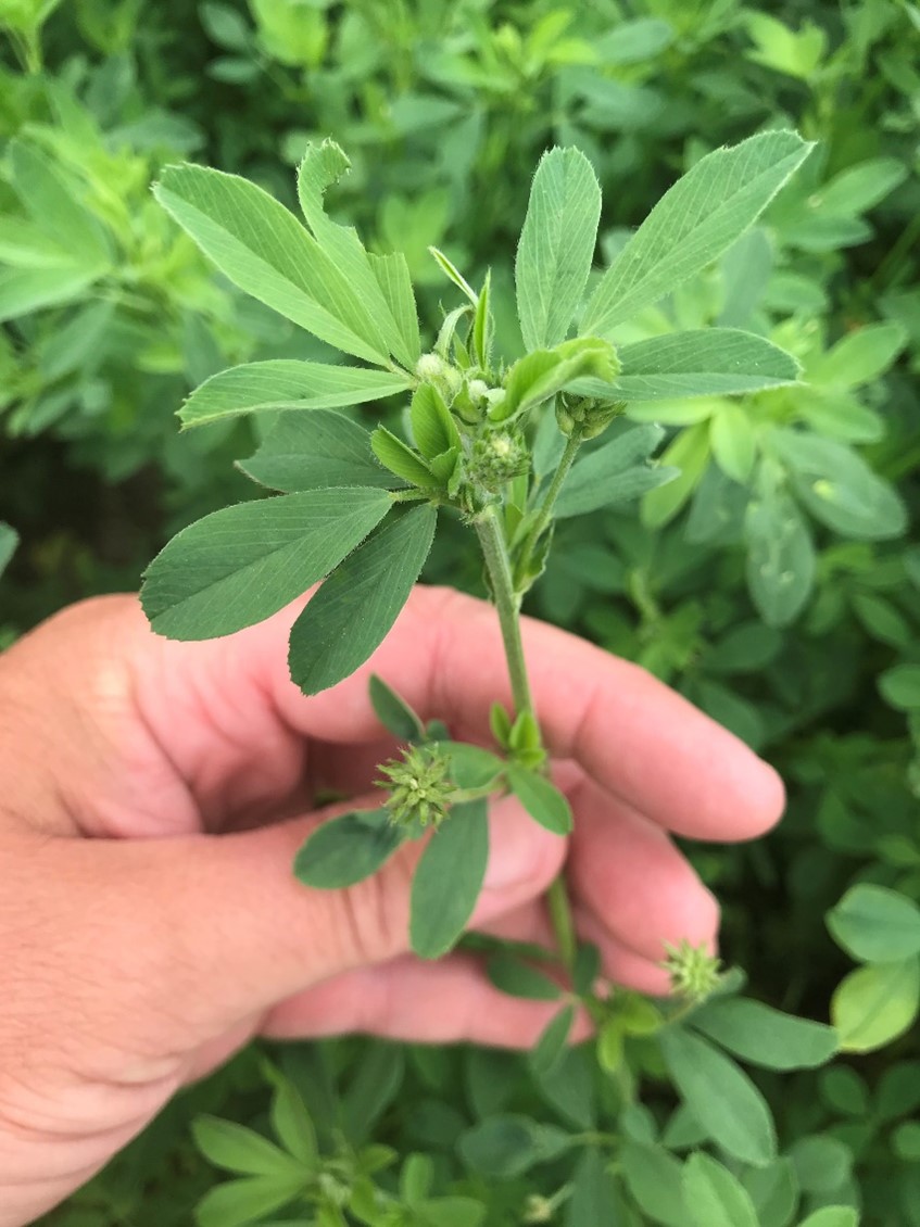
Alfalfa is currently in the early- to mid-bud stage and some fields have been harvested already. With the cool period in mid-April and again in early May, growth slowed to where we are closer to average with regards to expected first cutting. This is assuming that alfalfa weevil feeding has not reached threshold. MSU field crop entomologist Chris DiFonzo said she had not seen a field over threshold (40% of stems with feeding) as of late last week.
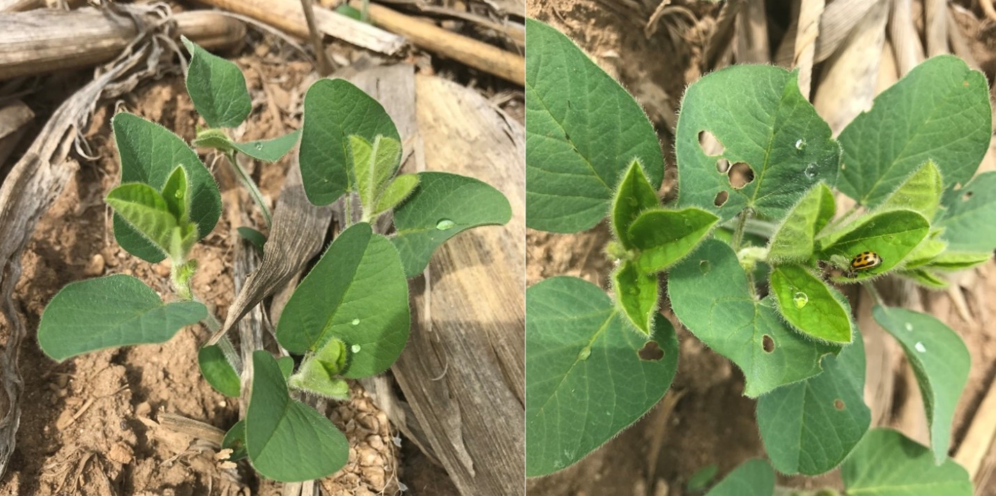
Corn planting progress continues to be well ahead of the average, according to the May 24 USDA Crop Progress report, with 88% of the corn crop in Michigan planted—20% ahead of last year and 30% ahead of the 5-year average. Soybean was 82% planted—18% ahead of last year and 42% ahead of the five-year average. Corn was 53% emerged and soybean 41%. Early-planted corn has reached V3-4 and stands look healthy. The first trifoliate leaves are out in soybean (V1) and only minor, sporadic feeding has been seen thus far in fields scouted.
MSU Extension soybean educator Mike Staton has visited fields with significant stand issues due to seed corn maggot. If you notice areas in a field with unexpected emergence issues, dig up several seeds to look for mushy seeds, white maggots, and penetration holes in the seed.
True armyworm and black cutworm moth captures continue to be low, although one true armyworm trap had 14 in Kalamazoo County and one black cutworm trap had 10 in St. Joseph County this past week. Reports from other parts of the state mirror what we are seeing down here. No black cutworm damage has been seen yet in our region—contact us if you find any issues.
Potato leaf hopper has been spotted in the state already. Andresen says that the weather system earlier this week with high southerly winds was likely an insect transporter. Hopefully they will not arrive before first cutting of alfalfa has wrapped up, but we will be monitoring this pest as the season progresses.
Weeds. With limited rainfall since mid-April, and especially in the last two weeks, there are concerns about the efficacy of PRE herbicides that have been applied. These herbicides (e.g., Dual, Prowl, Harness) require incorporation with light tillage or water in order to get to the weed seedling root zone to be effective. Generally, a 0.5-to-0.75-inch rainfall or irrigation event would be ideal but even 0.25 inches would help. For those not able to irrigate to water in the PRE, vigilant scouting is recommended early on, and early POST applications may be needed. If PRE applications were made this week, they should be sufficiently “activated” with rainfall.


 Print
Print Email
Email