Southwest Michigan field crops update – May 5, 2022
 Print
Print Email
EmailPlanting progress continues to be hindered by persistent rainfall and wet soils, but warm and dry weather forecasted for next week will enable a surge in fieldwork and overwintering crop growth.
Weather
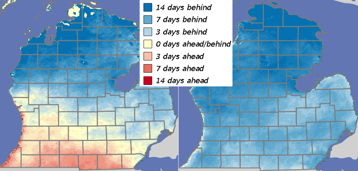
Temperature spoiler alert. This has been a cool spring. We started the month of April roughly a week ahead on heat units due to a couple of weeks of unusually warm weather in March, but we have dropped back to roughly a week behind normal due to below-normal temperatures this past month. The southwest region was 4-5 degrees cooler than normal this past week. These cool temperatures have made it hard for soils to dry out for any length of time. We have had a few warm spurts though and, as expected, soil temperatures have risen and have been hovering around 51 degrees for the past week.
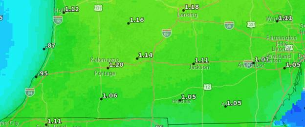
Now for the good news. Daily high temperatures will reach the 80s by the middle of next week with daily lows in the 60s. The added heat units and windy conditions beginning this weekend will result in a weekly reference evapotranspiration rate of around 1.1 inches with daily rates of 0.2 inches by the middle of the week. The medium-range forecasts call for very high chances of above-normal temperatures through the third week of the month.
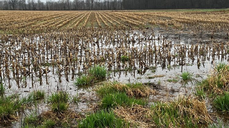
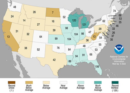
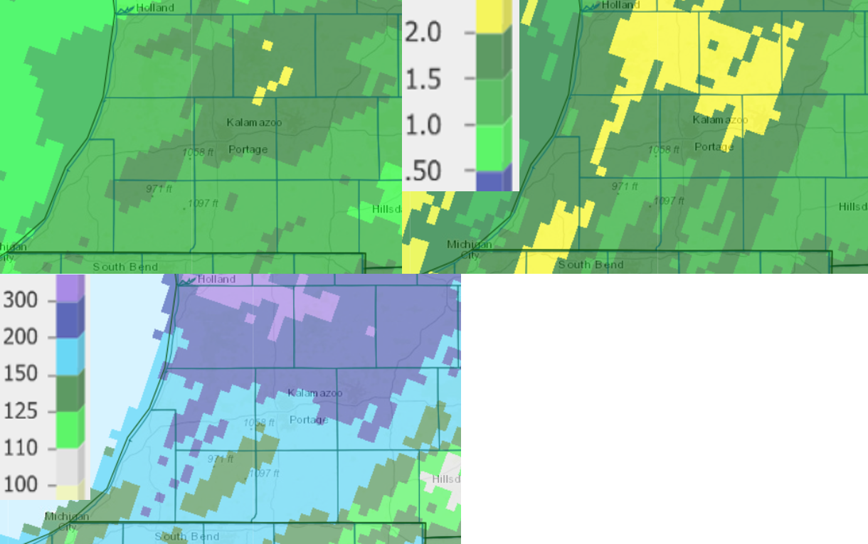
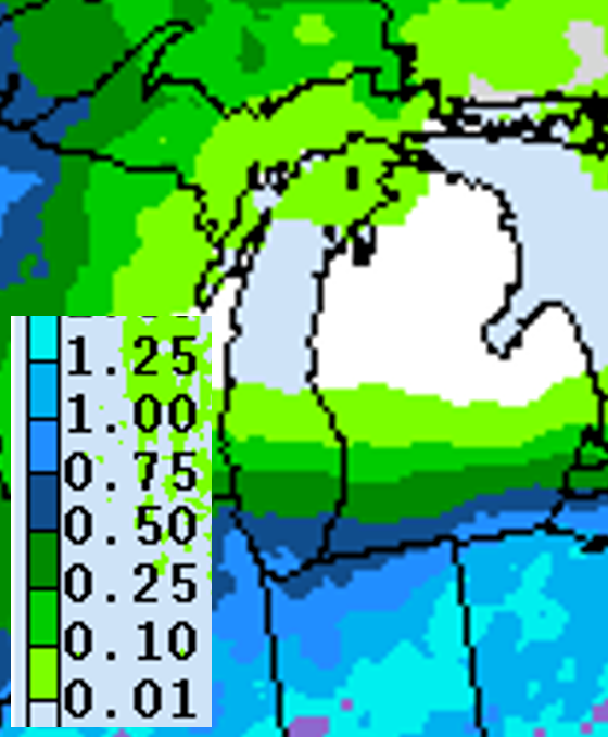
Precipitation spoiler alert. This has been a wet spring. March was the eighth wettest on record out of 128 years of measurements. According to the USDA Crop Reports for Michigan, there were 0.7, 0.5, 0.9 and 1.9 days suitable for fieldwork during the first through fourth weeks of April, respectively—that’s four days out of 30. Granted, on lighter soils we have had it a little better, but still. We have had 1.7 inches rain in the last week in the southwest and south-central regions on average as recorded at Enviroweather stations. Portions of Barry and Allegan counties have received 4 inches more rain than normal in the past 30 days while most of the region has received 1-3 inches above normal. The forecast is for an additional 0.25-1.0 inches with the weather system coming through on Friday, though most of the rain in that system will stay to our south.
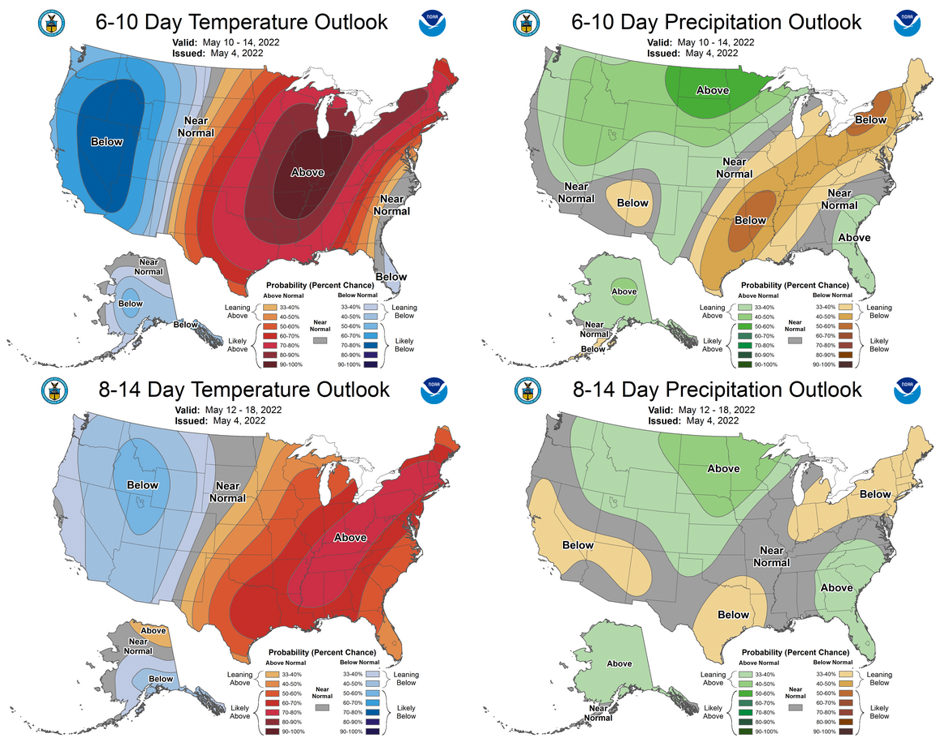
OK, now for the good news. There is little chance of rain for the seven days after this Friday. The precipitation chances will depend on where the western edge of the troughing feature sets up that will be bringing the warm and dry weather, but for now the prediction is that Michigan will remain dry. Both the 6-10 day and 8-14 day outlooks call for normal to below-normal rainfall through mid-May, and with the warmer-than-normal temperatures ahead, fields should dry out fairly quickly.
Crops and pests
Wheat in Michigan is rated at 45% good to excellent and early nitrogen (N) applications are starting to jumpstart growth in some fields. However, with the cold temperatures this past week—less than 130 GDD base 32 accumulated in the past week—the crop has not progressed much, and the growing point in the fields visited this week were still just above the soil surface in late-planted fields. Michigan State University Extension wheat specialist Dennis Pennington says wheat that was planted early or on time last fall has fared better and development has not been impacted as much by cooler temperatures, and many fields have reached jointing (Feekes 6).
Forages. Alfalfa roots in some fields have been impacted by long-term soil saturation with some tap root die-back according to MSU Extension forage specialist Kim Cassida. Once temperatures warm up and soils dry out, monitor fields that don’t get additional water as the smaller root systems will be less able to access deeper soil moisture and will decline. Forage growth will explode with the change in weather, but first cutting of hay will be delayed.
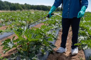
Corn and soybean planting officially began last week with 1% and 3% of the state reportedly planted to corn and soybean, respectively. I did see a few drills and planters out last week but did not actually witness seed going in, so some of those acres could be in our region. The windows for burndown applications have been slim thus far, but tillage operations were well underway before the recent rains. Avoid the temptation to jump the gun and begin planting before fields are sufficiently dried to avoid sidewall compaction.
Fruits appear not to have been significantly impacted by freezing temperatures last week according to several MSU Extension tree fruit educators. According to apple production specialist Anna Wallis, “We have seen a bit of [apple variety] ‘King’ damage due to low temperatures on April 16-17. Most of the damage has been in ‘Honeycrisp’ and ‘Gala’. We aren’t concerned about the crop at this time. There are still plenty of blossoms on the tree. This is especially the case because of the heavy bloom and potential crop we’re observing across the region.” Smaller fruits like blueberries are still coming out of dormancy and should not have been impacted by the freezing temperatures.
Insects. Moth trap counts in the region this past week were mostly unchanged from last week except for one trap for each species. These traps are less than 20 miles apart from each other, so the variability in counts reflects the random nature of where these moths will actually drop out from strong winds. The same was found with Purdue’s trapping network where most of the northern tier of counties are still seeing less than 10 moths, but there were a few impressive catches as high as 44 true armyworm (LaPorte County) and 83 black cutworm (Lake County) last week. According to Purdue’s field crop entomologists, with the delayed planting this spring, black cutworm could pose a threat to corn, particularly in fields where control of broadleaf weeds is continually delayed.
On the MSU Extension Field Crops Virtual Breakfast this week, field crops entomologist Chris DiFonzo warned that seed corn maggot, which are attracted to rotting vegetation, will attack seed that was sown earlier this spring and has been sitting in cool, saturated soils. If you were able to get any planting done in the last couple of weeks, monitor emergence and stand development on those fields.
Moth trap counts for true armyworm (A1-4) and black cutworm (B1-3) in St. Joseph and Kalamazoo counties.
|
12-Apr |
19-Apr |
26-Apr |
3-May |
|
|
A1 |
3 |
1 |
3 |
9 |
|
A2 |
0 |
0 |
5 |
4 |
|
A3 |
1 |
1 |
0 |
0 |
|
A4 |
0 |
0 |
0 |
1 |
|
B1 |
0 |
1 |
4 |
1 |
|
B2 |
0 |
0 |
4 |
30 |
|
B3 |
0 |
0 |
5 |
4 |
Post-emergence weed control was the topic of this week’s MSU Extension Field Crops Virtual Breakfast with weed specialist Erin Burns. Burns began by referencing an interesting study conducted at MSU about 10 years ago looking at how much nitrogen (N) applied to corn was taken up by weeds compared with how much was taken up by the corn crop. The results showed that a significant amount of N was taken up by weeds that were not controlled until V4-V6 stage corn, and with N prices this year, that resulted in a loss of up to $107 per acre. The moral of the story is to control weeds early in corn to avoid early-season competition for nutrients.
Nitrogen uptake by weeds and corn at different corn stages and fertilization rates and the potential economic impact. Data excerpted from Lindsey LE et al. (2013). Graph courtesy of Erin Burns.
The key to avoiding yield loss in a weed control program is to begin with tillage or an effective burndown application followed by a full rate of a preemergence herbicide and then a postemergence herbicide application including a residual at the best timing. Burns explained weeds can grow 2-4 inches per week with an average corn yield loss of 0.9 bu/ac/day when weeds are not controlled. Waiting until weeds were 4, 6, 9 or 12 inches tall to control them (compared with controlling at 2 inches tall) resulted in corn yield losses of 3, 6, 9 and 22%, respectively, according to a study by Gower SA et al. (2003). However, when considering when to make a postemergence herbicide application, farmers also need to keep in mind the crop growth stage (check the label) and the rotation restrictions for the next crop planned (check the label).
For information about controlling specific weeds, visit the MSU Weeds website. Given the late start to the spring, you may also find the Cover Crop Termination bulletin useful. Also, consider attending the 2022 Weed Tour on campus scheduled for June 29—stay tuned for details as the date gets closer.
If you were not able to join the session, the recordings will be closed-captioned and available at the Field Crops Virtual Breakfast webpage and the MSU Extension Field Crops Team social media platforms: Facebook, Spotify, YouTube, Apple Podcasts and Twitter.