MSU researcher participates on international team that finds that a quarter of Africa's trees are located outside areas classified as forest
 Print
Print Email
EmailDiscovery opens the door for future carbon mitigation efforts, better land management
MSU Department of Forestry professor David Skole, in partnership with NASA and European collaborators, led a team of researchers on a quest to count and map every tree in Africa using precise satellite imaging captured over the course of a year. New results from this research were published in the journal Nature Communications this week.
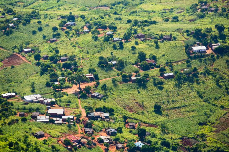
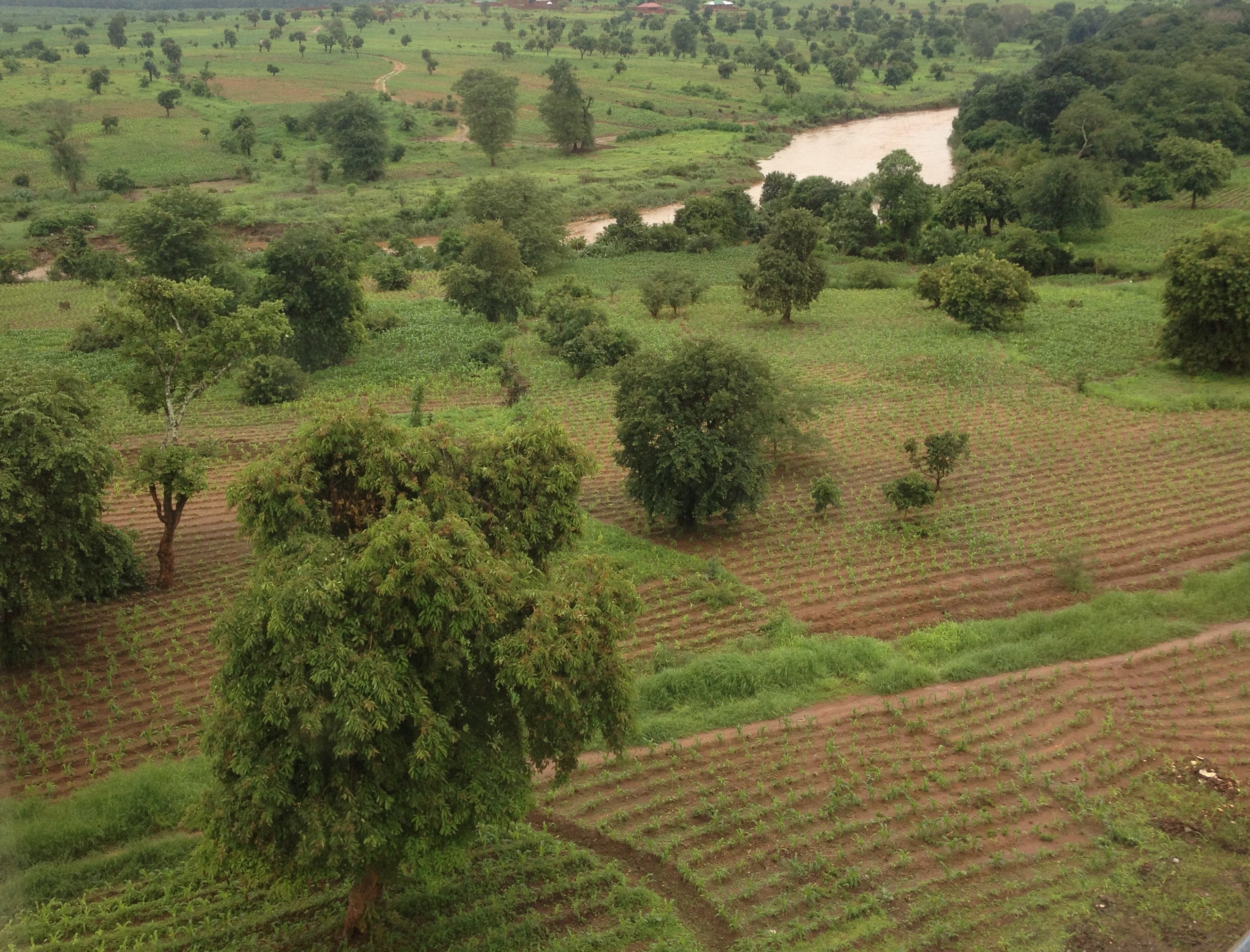
Researchers ultimately discovered that 29% of tree cover in Africa is found outside areas previously classified as woodlands or forests – such as in croplands and grassland.
Such precise mapping of tree cover, down to the level of individual trees, has the potential to redefine land-use impacts, build a basis for natural climate solutions through novel land-use practices, and provide a new scientific basis for elevating tree-based analysis to support climate change mitigation policies and actions, and enhance local livelihoods at the same time.
Previous monitoring systems were unable to account for trees outside of forests and other mapping efforts are too costly to reproduce on a consistent basis. Skole and his team partnered with NASA to use high-resolution images from PlanetScope nanosattelites, allowing precise tree counting to rectify previous errors in tree calculations.
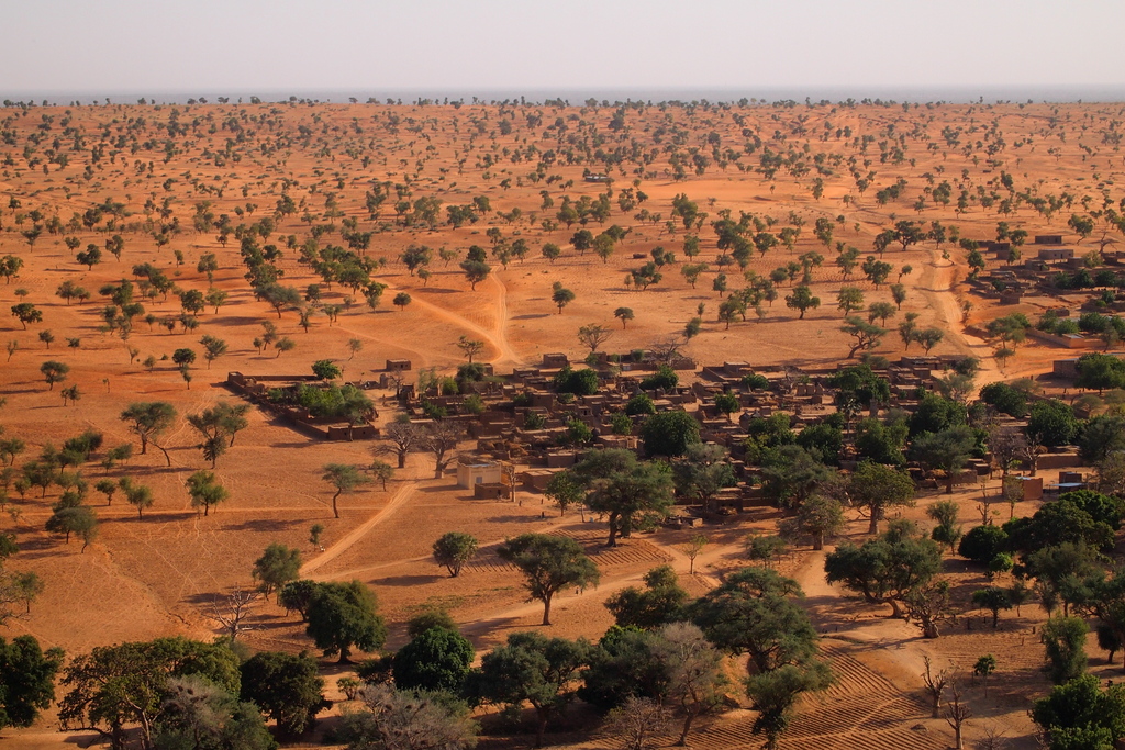
The first leg of Skole’s research began in Malawi, with the goal of counting trees outside of forests in the southeast African nation. Precision imaging allowed researchers to account for trees in areas as small as 0.1 hectare (1/4 acre), when previous tree-cover mapping was done on a scale of 1 hectare (2.5 acres). Next the team developed the means to use very high-resolution satellite data to detect and map individual tree crowns in Senegal at the resolution half-a-meter (5 square feet, 0.0001 acres), which is “smaller than my kitchen table”, says Skole.
The project in Senegal proved the concept that a full accounting of tree cover down to the individual tree level was possible on a countrywide scale, and Skole’s team and collaborators began to scale up the project.
Next, the team attempted to account for tree cover on a national scale in Rwanda, but in addition attempted to detect tree-level carbon stocks. A carbon stock is a system in which carbon can be stored or released. The Rwanda project allowed researchers to account for a complete picture of the nation’s carbon stock.
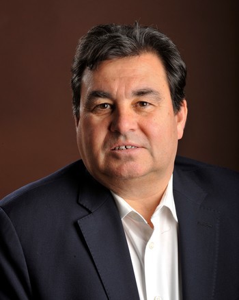
“Scaling up to the entire continent of Africa, we can now specifically measure trees to inform us on what needs to be done for moving forward to improve carbon mitigation efforts,” said Skole, whose MSU AgBioResearch funded research focuses on land-use change, the global carbon cycle, and identifying mitigation and adaptation solutions.
Mapping trees on a more precise scale allows land managers to adjust their mitigation and planning efforts for their unique tree cover and land-use needs.
“Tree cover has no meaning,” Skole said. “Yes, you can detect it, you can say ‘this 30-by-30 meter area probably has trees,’ but you need to plant individual trees and monitor the success of tree planting at the individual scale. This way you can monitor progress over time as they grow and sequester.”
The research team now hopes to use the data gathered through satellite imaging to model potential carbon storage and mitigation options in these previously unaccounted for areas of tree cover in Africa.
In addition to having new very high-resolution earth observation satellite data in massive amounts, detection of individual tree “objects” is achieved using new machine learning, which involves computerized programs that train themselves to detect and “draw" complex patterns and spatial objects such as trees and tree crowns. MSU forest carbon experts can then build new models that relate these tree attributes to the weight of the tree, which in turn can be numerically converted to the tree’s stock of carbon, because we know that half of all living tree mass is comprised of carbon.
Using the MSU high performance computing center’s Institute for Cyber-Enabled Research Center (ICER), as well as collaborating computing centers in Copenhagen and NASA, these algorithms can be applied to tens of thousands of high-resolution satellite images, more data and information in bytes than twice the amount in the MSU library. A combination of massive data, new algorithms, new forestry models, and new computational infrastructure produce billions of trees and their assigned carbon stocks.
Mapping and monitoring tree systems outside of forests will allow for better carbon sequestration efforts on a local, national and eventually global scale. Mapping and monitoring carbon stocks is one of the most important factors of climate change mitigation, and demand for accurate tree accounting is high.
“The next step is taking science out of the lab, and putting it into practice,” Skole said. “We can put the science of monitoring in the hands of people that can use it.” For that, the team is now funded by the World Resources Institute, the Bezos Earth Fund, and the African Union Development Agency to enable advanced continent-wide measurements of carbon stocks in tree-planting, agroforestry and other natural climate solutions projects across all of Africa.