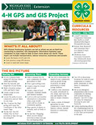
Michigan 4-H GPS and GIS Project Snapshot (4H1653)
February 27, 2015
 GPS (Global Positioning System) can tell us where we are on Earth by connecting to satellites. GIS (Geographic Information Systems) uses computers to layer maps to help us learn more about our world. These layers can include transportation, natural resources, businesses and people.This 4-H snapshot sheet covers what 4-H’ers can learn from a 4-H GPS and GIS project, ways to get involved and resources for learning more. This is one in a series of Michigan 4-H snapshot sheets on a variety of topics. (2 pages, 2014)
Michigan 4-H GPS and GIS Project Snapshot (4H1653)


 Print
Print Email
Email


