Southwest Michigan field crop update – May 31, 2019
With drier weather in the forecast, growers must decide whether they will be able to get planted as soils dry out or consider other options this year.
Weather
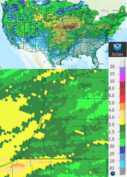
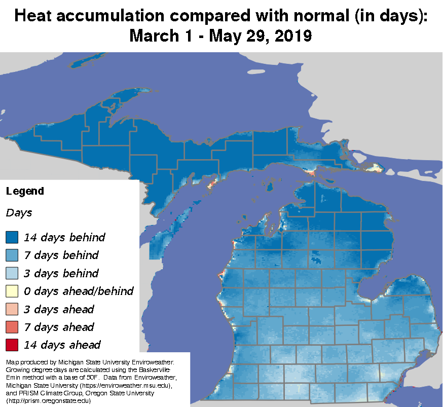
We received another 1.5 inches of rain on average in our area this past week—exact same story as last week. We caught up on heat units and are now only a few days behind. We heard reports of soil temperatures dropping into the mid-40s north of Lansing, Michigan, this past week, but our minimum soil temperatures have held steady in the lower-60s, so crops that get planted should emerge fairly quickly.
The jet stream pattern we have had for the last several weeks that has brought repeated rain cycles is predicted to change around midweek next week, which should bring drier weather to Michigan. Interestingly, that pattern has resulted in 200 more tornadoes so far in 2019 than we typically see in an entire year in the U.S.
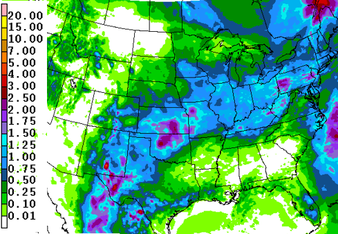
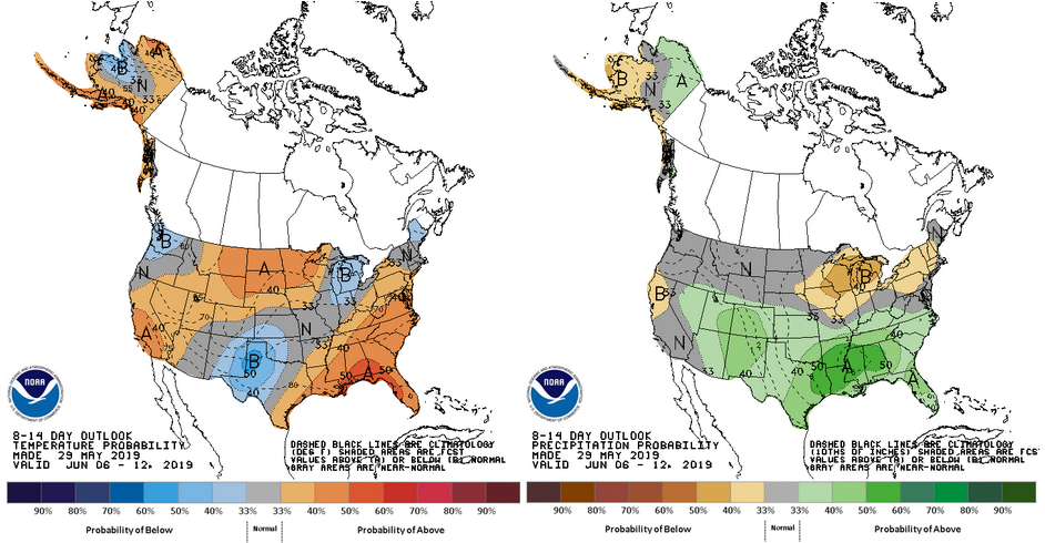
The front that should be making its way through Michigan on Saturday, June 1, will bring scattered showers with 0.25 to 0.5 inch of rain but will be followed by a few days of cool and dry conditions. The next chance of rain won’t be until midweek next week. The 8-14-day outlook calls for cooler and drier than normal weather, so we have a good chance of making up lost ground in the first two weeks of June.
Crops
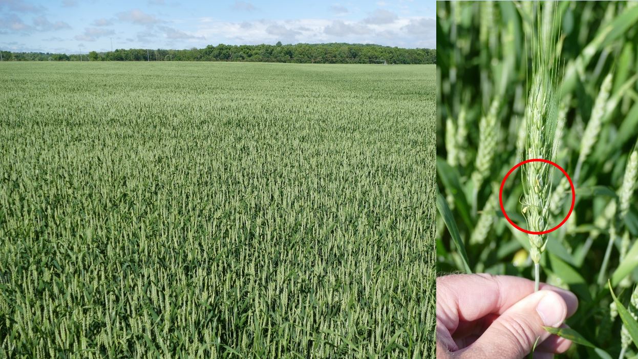
The USDA Crop Progress statistics from May 26, 2019, report that 1% of wheat has headed in Michigan (13% behind average) and only 8% is rated excellent (additional 31% and 34% rated good and fair, respectively). A few fields visited are at Feekes 10.5 (heading complete) but have not reached flowering/anthesis yet (Feekes 10.5.1). Those earlier fields are within days of the ideal time for a head scab fungicide application if warranted; Caramba, Prosaro and Miravis Ace are recommended. The ideal timing is anthesis or seven to 10 days following. The Fusarium Risk Assessment Tool is a weather-based model that will give you a sense of the level of risk (see screenshots below).
No signs of foliar feeding were seen, even though one field is adjacent to the AW moth trap at the top of the table above, and only minor disease symptoms on lower leaves. No disease was detected in any UW-Madison wheat plots either, although they have not yet headed.

According to the latest crop progress report, Michigan corn was 33% planted as of May 26. We are reportedly 7% emerged as of last week, and most of that is probably here in the south. Stands look good and are mostly at V2.
According to the latest crop progress report, Michigan soybeans were 23% planted as of last week and 5% emerged as of last week. No-till beans planted May 21 in a local inoculation study show less than ideal emergence, and those that are up are at VC. Other beans that are up are at V1 or so.
We have accumulated 717 growing degree days (GDD) base 41 F on average since March 1 across the south-central and southwest Michigan region (ranging from 567 GDD in the north to 808 GDD near the Indiana border). With optimal cutting to begin at 680 or 750 GDD 41 depending on silage storage, first alfalfa cutting is expected as soon as fields are dry enough to enter. The challenge will be getting the forages off before quality declines significantly and getting crops planted. Thomas Kilcer from Cornell University says to prioritize the hay crop above getting silage corn planted for those with that particular decision to make.
Other important news
Here are a few other news topics you might find important. A brief summary is given here, and you can read the full version on the Southwest Michigan Field Crops Newsletter, which is posted on the St. Joseph County Agriculture webpage.
Delayed versus prevented planting decision tools. The Field Crops Virtual Breakfast session on May 30 featured MSU Extension farm management educator Roger Betz talking about prevented planting considerations, including exploring a tool produced by the University of Illinois farmdoc group that allows you to put in your own numbers to see which option is the most profitable.
Corn emergence timing. As we (hopefully) get caught up on planting in the coming week, it is helpful to know the timing of when we can expect emergence and key growth stages in corn. The Southwest Michigan Field Crops Newsletter includes a couple of tools that can help.
Impressive armyworm flights continue. Armyworm counts in Indiana are still impressive whereas this week’s numbers from Michigan tapered significantly at most sites.
MSU’S industrial hemp resources now available. A bulletin and FAQ are now available as a free download at MSU’s Hemp Production website.


 Print
Print Email
Email