Two new Michigan Sea Grant educational tools focus on our Great Lakes
 Print
Print Email
EmailTeaching Great Lakes Science and Great Lakes FieldScope are two new online tools to learn more about our Great Lakes at home or in the classroom.
The Great Lakes provide a unique educational opportunity to students and residents of all ages. Two new tools from Michigan Sea Grant help bridge that connection: Teaching Great Lakes Science and Great Lakes FieldScope.
These new resources are designed to encourage people to explore the Great Lakes, whether at home or in the classroom. Educators and learners alike will find complete lessons, data sets, educator resources and a very dynamic mapping tool.
Teaching Great Lakes Science is a website that offers lessons, activities and data sets for K-12 and informal education. The multidisciplinary resources are easily incorporat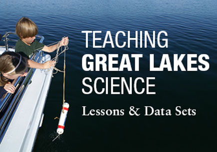 ed into existing curricula and address science, technology, engineering and math subjects. For example, the resources explore climate and weather; lake effect snow and ice cover; physical properties of water; food webs and chains; native fish and habitat restoration; and harmful algal blooms, beach health and water quality. Some of the lessons originally appeared in the Great Lakes Education Program curriculum, developed by Michigan State University Extension in partnership with Michigan Sea Grant.
Leading Great Lakes scientists, including Donald Scavia, Thomas Johengen and David Schwab, contributed scientific content. "These two new online tools are excellent examples of translating important scientific content into practical applications, in this case, for helping educators and students better understand the Great Lakes," said Scavia, director of 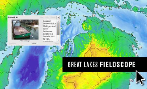 the University of Michigan’s Graham Sustainability Institute. "I'm very glad to have contributed."
Great Lakes FieldScope is a web-based mapping, analysis and visualization tool, hosted by the National Geographic Society that can be used to investigate real-world matters like water quality or fish spawning grounds. The rich geographic context helps people gain a better understanding of their connection to the Great Lakes.
Users can explore rivers and streams, watershed boundaries, water depth, political boundaries, elevation and land cover. FieldScope participants can upload their own field data— including photos, measurements, field notes—, and compare it with data collected from other areas.
Michigan Sea Grant partnered with Eastern Michigan University, the National Oceanic and Atmospheric Administration's Great Lakes Environmental Research Laboratory, the U.S. Geological Survey's Great Lakes Science Center, the Great Lakes Observing System and National Geographic to create these educational tools.