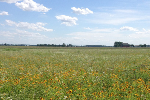
Using models to predict fusarium head blight and DON levels in wheat
 Print
Print Email
EmailAs mentioned elsewhere in this issue of the Field Crop CAT Alert (see Folicur Fungicide for Wheat Head Scab) a fungicide application must be timely to be effective.
Editor’s note: This article is from the archives of the MSU Crop Advisory Team Alerts. Check the label of any pesticide referenced to ensure your use is included.
As mentioned elsewhere in this issue of the Field Crop CAT Alert (see Folicur Fungicide for Wheat Head Scab) a fungicide application must be timely to be effective. The window for application is very narrow – from 75% heading up to about 25% flowering – a period of only a few days.
Over the years several models have been developed to help growers predict in advance whether or not an application of tebuconazole will be needed to control Fusarium head blight (FHB) and the associated mycotoxin, deoxynivalenol (DON, vomitoxin) that develops in the wheat kernels. Two such models are the Penn State Model, which predicts the risk of FHB and the DONcast model, which predicts the levels of DON. Both of these models involve the use weather data and some observation of crop development stages on the part of the grower. This article will cover the Penn State Model. Next week, we’ll provide details about the DONcast model developed at Ridgetown University in Ontario, Canada.
The Penn State Model is designed to predict the risk probability of an epidemic with greater than 10% severity based on observed weather patterns. Different models are used for spring and winter wheat. The winter wheat model is based on the interval of time that relative humidity is 90% or greater with temperatures between 48 and 85°F (9-30°C). Regardless of the wheat class, you will need to identify the date at which 50% of the heads are flowering in your field. Wheat is most susceptible to FHB infection during flowering. The model uses weather conditions observed during the seven days prior to the flowering date you select to predict the level of risk. You can select a risk prediction based on the previous seven days’ weather, six days and a 24-hour forecast, or five days and a 48-hour forecast.
The Penn State model is available at the website http://www.wheatscab.psu.edu/. Select the risk map tool on the menu, then follow the directions to choose an assessment date, wheat type and state. Once you select the state ( Michigan), the weather station locations will appear on a map of the state. Clicking on an individual station (represented by a purple dot) will bring up the previous seven days’ temperature, rainfall and risk probability for that station point. The models are “tuned” to reflect average rainfall.
In the past, model predictions have not always reflected risk accurately when an area has been under extended periods of drought or higher-than-normal rainfall. A means to help address that issue has been to allow for input by the state Extension specialist to provide additional commentary that may not be reflected by the risk maps, including information about rainfall or drought conditions, and wheat growth stages in specific areas of the state.
The models have an accuracy of about 80% given the data used to develop and test the models. They are intended as a decision aid to be used along with other resources, such as weather forecasts, grain markets and local expert advice to help you with disease management decisions. Weather conditions that take place during flowering and grain fill of the crop are not part of the model and could significantly affect the development of disease and accumulation of mycotoxins. This year, Michigan is part of a pilot project that will allow for additional commentary on the risk maps. The commentary will provide information about rainfall, drought and growth stages of wheat in various parts of the state (not reflected by the risk maps), that we hope will enhance the usefulness of the maps. This commentary feature will only be available for Indiana, Kentucky, New York, Ohio and Pennsylvania.