Coastal Planning and Zoning Course: Lesson 1
DOWNLOADDecember 9, 2021 - Tyler Augst, Michigan State University Extension and Michigan Sea Grant
 Print
Print Email
Email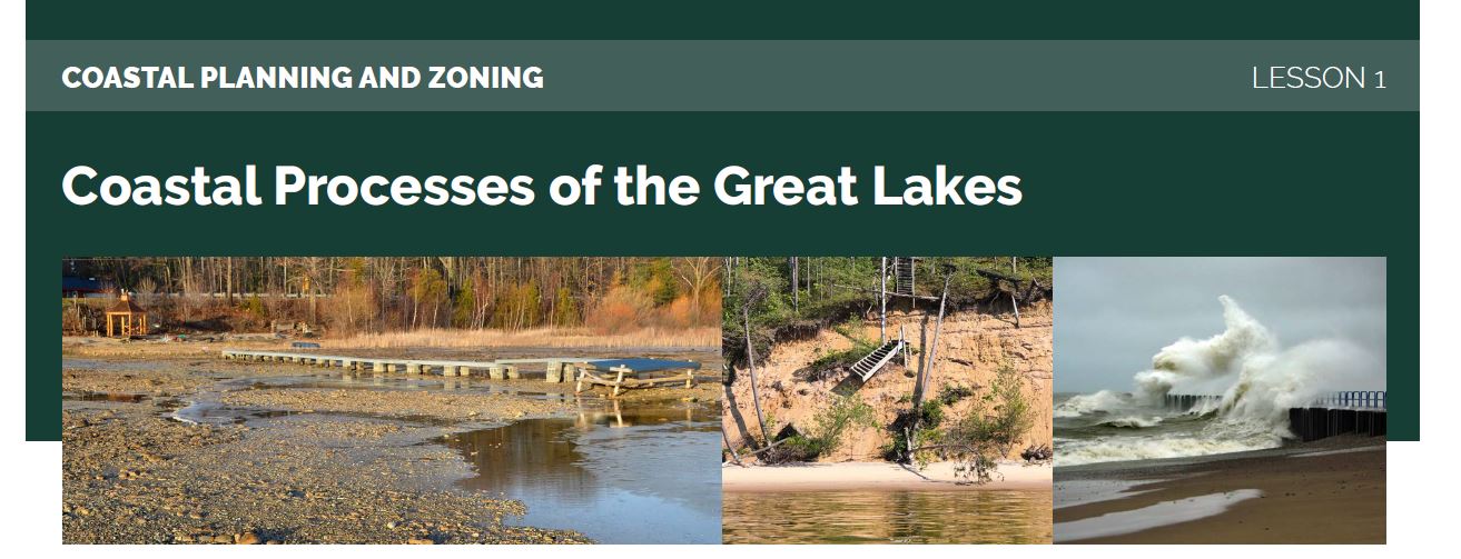
This lesson is one of a 5-part e-mail series on Great Lakes coastal zoning and planning. Register for the complete series online.
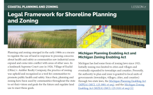
Lesson 1: Coastal Processes of the Great Lakes
Good planning and zoning should be based on both community input and analysis of current information and science. Michigan Sea Grant, alongside the rest of the Sea Grant Networks, helps to make this a reality by connecting communities to the science of the Great Lakes as well as tools and resources to engage with residents and communities. This first lesson in your email short course focuses on Great Lakes science to build a foundation for the planning and zoning lessons to come.
Great Lakes water level fluctuations
Many people are familiar with ocean tidal cycles, but might be surprised to learn that the Great Lakes have their own water level fluctuations, although on a much longer scale than the twice a day ocean tides. The Great Lakes have seasonal and multi-decadal water level cycles. From the lower water levels in winter to the generally high water levels in early summer, Great Lakes water levels see an average of 12-18 inches of fluctuation. Great Lakes water levels also vary from year to year. These changes depend on the balance of precipitation, runoff, evaporation, and river flows. Consistent high precipitation or low evaporation can lead to periods of high water. Consistent low precipitation or high evaporation can lead to periods of low water. Lakes Michigan, Huron and Erie have a difference of over six feet between their record high and low water levels. Lake Superior has a difference of just under four feet.
These fluctuations in the Great Lakes water levels are measured through a joint effort between the U.S. National Oceanic and Atmospheric Association (NOAA) and Canada’s Department of Fisheries and Oceans. In Michigan, the Detroit District of the U.S. Army Corps of Engineers assembles the data and creates seasonal water level forecasts. NOAA’s Great Lakes Environmental Research Laboratory (GLERL) offers more details on this network of monitoring stations, and the Great Lakes Water Level Dashboard from NOAA displays the measurements. GLERL’s Water Levels Story Map is another great resource for more reading.
With these varying water levels, it is important for individuals and communities to be prepared, for both low water levels like Michigan experienced in 2013 or the high water experienced in 2020. A key part of that preparation is understanding the processes of the Great Lakes and how those processes impact your coastal community. Michigan Sea Grant is a great resource for learning more about resilient coastal communities and many other topics.
The dynamic shoreline
Geologically speaking, the Great Lakes are a fairly young feature, having been created by glaciers about 10,000 years ago. (For reference the oceans formed around 3.8 billion years ago.) Michigan has a total of over 3,000 miles of coast experiencing the cycles of high and low water described above. That is more than double the entire West Coast. That coastline includes sandy beaches and dunes, unique coastal wetlands, rock shorelines, and developed urban areas that are all dynamic systems that experience the impacts of waves, currents, and sediment, like sand, being moved around. The impacts these processes have on the coast change as water levels fluctuate. This video from Michigan’s Department of Environment, Great Lakes, and Energy (EGLE) provides a great introduction to our coastlines.
Shorelines in a changing climate
The processes outlined above paint a picture of a very dynamic shoreline with water levels rising and falling. And as this video from EGLE’s Building Coastal Resilience Series explains, those processes are becoming more intense with our changing climate. A later lesson will introduce some tools for communities to use to plan for this uncertain future, but first it’s important to understand what is changing.
As this fact sheet from the Great Lakes Integrated Science and Assessments explains, there are many impacts of a changing climate that can be seen across the Great Lakes region. From 1951 to 2017 there has been an increase in both total precipitation and the amount of heavy precipitation events, and projections expect these trends to continue. While there are many factors that go into lake levels, projections indicate the future will bring increasing variability in lake levels as we move back and forth from periods of high water to low water. Of course these impacts will vary regionally so local information and data are key!
Michigan Sea Grant has a wealth of resources on climate change to explore, including one on the impact extreme storms can have on public health, community safety, and economic stability in the Saginaw Bay Region and tools to assess those risks. With a proper understanding of the processes and risks at play, communities can begin to take steps towards planning for climate adaptation, such as increasing their knowledge through continuing education like this email course.
Resources for property owners
The MSU Extension article “Protecting Your Great Lakes Waterfront Investment,” has some great tips for landowners along the Great Lakes shoreline for living with and stewarding these dynamic shorelines. Landowners looking for more information can find it in this booklet, Along the Shore: A Shoreline Management Guide for Michigan Coastal Land Owners.
For more about the coastal processes that make the Great Lakes shorelines so dynamic see the section on “Natural Processes that Affect the Coast” in Living on the Coast: Protecting Investments in Shore Property on the Great Lakes from the US Army Corps of Engineers and Wisconsin Sea Grant. After an introduction of coastal processes this resource details options available to property owners for living with those processes.
What’s next?
This was your first lesson in this email short course. For more information on the Great Lakes, visit the Michigan Sea Grant’s website, sign up for the Upwellings Newsletter, order something from the bookstore, or reach out to a Michigan Sea Grant staff member near you.
You will be receiving links to four more email lessons like this one exploring some introductory topics in planning and zoning for your shoreline community. With our introduction to the physical coasts complete, the next lesson will focus on the legal framework of planning and zoning along Michigan Great Lakes shorelines.