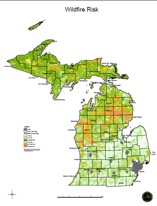
Michigan statewide wildfire risk map
DOWNLOADMarch 16, 2017 - Michigan State University Extension
This map produced by the Michigan Department of Natural Resources (MDNR) identifies wildfire risk utilizing factors such as land cover, canopy, and soil dryness. County boundaries and major cities are noted.
You Might Also Be Interested In
-
Farm to School Local Food Purchasing Incentives: What if States Funded Farmers to sell to Schools?
Published on May 29, 2024
-
Farm to School Local Food Purchasing Incentives: Incorporating Additional Values
Published on May 29, 2024
-
Expanded Local Food Purchasing Incentives: Programs that Reimburse More Than Local Food
Published on May 29, 2024
-
Farm to School Local Food Purchasing Incentives: The Benefits of Local Food Purchasing Incentives
Published on May 29, 2024
Accessibility Questions:
For questions about accessibility and/or if you need additional accommodations for a specific document, please send an email to ANR Communications & Marketing at anrcommunications@anr.msu.edu.