The Prairie River Water Use Issue – State Agency and User Group Round Table
 Print
Print Email
EmailFebruary 27, 2024
More Info
Expansion of large volume water use in the Prairie River is at a standstill with DNR and private funded temperature studies ongoing; what is the future of the water use in the Prairie River?
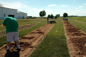
The 2024 MI Ag Ideas to Grow With conference was held virtually, February 19-March 1, 2024. This two-week program encompasses many aspects of the agricultural industry and offers a full array of educational sessions for farmers and homeowners interested in food production and other agricultural endeavors. While there is no cost to participate, attendees must register to receive the necessary zoom links. Registrants can attend as many sessions as they would like and are also able to jump around between tracks. RUP and CCA credits will be offered for several of the sessions. More information can be found at: https://www.canr.msu.edu/miagideas/
Video Transcript
Hello, my name is Lyndon Kelly. I work for Michigan State University Extension and Purdue Extension. But today we're talking this last program of the day part of Michigan AG Ideas to Grow With the water day section, the irrigation section. We're talking about the Prairie River and part of the registration process in the Prairie River. As a quick reminder, I'm going to move right in here. As a quick reminder, in 2,006 and 8 we had legislation in Michigan that helped us enable us to be part of the Great Lakes Charter. Part of that legislation said that we had to come up with a registration and a reporting system for people that were large volume users. Those were people using greater than 70 gallons a minute from one or more wells. And part of that registration system was that we needed to be able to avoid adverse resource impacts. We've over the last 15 years, have developed a system that estimates impact to the local stream from your proposed water withdrawal, whether it be a surface water withdrawal or a well. And then we look at that streams impact and compare it to what its August flow would be and the characteristic fish population. What's changed recently is there's a proposal and an effort to collect data on the Prairie River, the Branch County section of the Prairie River. The Prairie River is divided at the Branch, St. Joe County line, the Prairie River section in Branch County. They want to change the characteristic fish population, which is defined by the stream characteristics and greatly lowers the amount of water that is available for registration. That's my quick take at it. Yeah. First, I'm Jay Wesley. I'm the Lake Michigan Basin Coordinator. So I'm more of a administrator now. And I oversee all the staff in the Lake Michigan Basin and one of our offices goes out and does survey work on streams and lakes. Back in 2011, they just happened to be doing a random survey on the Prairie River. They found that they found trout, amongst other species, brown trout, and they saw that the temperature was fairly cold. That brought up some questions because the stream is characterized as a warm water system in the water withdrawal tool. So they asked folks that were at the time representing DNR on the Water Use Advisory Council, what should they do. We didn't have any policy at that time. They just continued to collect water temperature data and getting fish data and did so for three to four years or so. Based on the information that they gathered, they ran it through some tools that were developed called the water Withdrawal Assessment or tool, and found that it shouldn't be warm, that they had enough information that actually suggested that it should be cold transitional. And we're completely just looking at this from a resource standpoint, right? We go out and you look at fish and want to protect things that involve fish and fish habitat. So that's kind of where we're coming from. But in the meantime, we had this data, but there was no policy established in terms of how to change the stream classification. It wasn't real clear who had the actual decision. After digging into it some more, the Water Use Advisory Council actually established what's called technical underpinnings and they asked the DNR to come up with policy for changing stream characters characterization of categories. So that was not completed until 2021. Once that was done, our staff ran the information that they had through the tool. They brought the information to the DNR director, who we believe has authority to make changes to stream classification for public input. We went through an established system in the DNR which we used to change fishing regulations and hunting regulations. It went to the Natural Resource Commission. This was in December. And we presented the information that we had. The director had some questions on that, but we were getting a lot of concern and questions from the general public, especially folks that own property in the area, in the watershed. They just had a lot of questions on the process, how we got our information, notified landowners and water users within the system, a public to the director. Our director decided to delay a decision and basically wanted to make sure that any data collection was done following the policy to a T, and wanted a third party to be involved with that data collection, and wanted three additional years of data collection, that that decision was made early winter of 2022. So the DNR then contracted a consultant, Kaiser and Associates, and they were brought on board to do stream temperature measurements and air temperature measurements at five locations within this water use area. And we did get data back in 2023. So we've got our first information to look at what we found. And this will be the last thing, comments I made but make in the very headwater areas, we found that the water would have characterized as warm, then it transitioned into a cold transitional area through the middle of the water use area. And then the last two sites which are further down in the lower part of the water use area were cool. It's a very interesting watershed and it does change as you go through it. So there's a lot of intricacies that we need to understand, but definitely, depending on where you take measurements, you can get a different result through this watershed. We're looking forward to continuing two more years of data and then running this through our tools and seeing what we come up with with more extensive data at more locations. That's how I got involved and I don't know Lyndon, if you want to pass it on to . Sure. I know Todd has been taking some measurements in that watershed as well. Yeah, Thanks, Jay. We had been working with a couple of the growers in the area and they asked us to do some measurements out there. We've been collecting water temperature and stream discharge measurements to construct, gain loss surveys up and down the river. And we've also been looking at stream bed connectivity. We've been testing that as well. We're finding pretty similar to what Jay had just said, our trends. We've a total of eight temperature loggers, eight different sites in the Prairie River. Then we've also got two temperature loggers in two additional tributaries, both of which were under consideration in the original reports for reclassification. Burrok drain and then the counter ten ditch or the Ruska. However, it's known locally, we found very similar trend where it's warming from upstream to downstream. The only exception to that was at Sher Road site. It actually got colder as we moved downstream from Steffi Road, but we were able to actually associate that with the drain commissioner had actually dredged that section of the river this past year. That was the only place where we saw it actually get a little bit colder, but it's very border line. What we're finding is the upper portion of the Prairie River, again, is probably in the cool temperature range. The lower portions of it below US 12, all those are coming back consistently as a warm stream, which I think is what the current classification is over there. That's the work that we've been doing. So we've got two more years to go yet, obviously, for it to be the three year period of record, the only other things that I would say that's the work that we're doing. The things that I would say I think that are probably helpful for the group as a whole would be. There's two big things that we faced when we were talking about this the very first time. How do you effectively communicate? There's a lot of heat, there's a lot of noise, there's a lot of emotion attached. Effective communication to us being really, really clear about what your issues are and what's possible solutions are. But also being very concise about that people aren't going to listen for more than a minute or two before they want to move on to the next person. Then the other one was, especially if you're working with a group, that everyone in the group has a consistent message. Everybody's saying the same thing on the same page, believing the same things about how you're working through it. That had to do with how do we effectively communicate clear, concise, and consistent. The other one that continues to come up, not just in this case, but in other hot button issues, is how do we build trust. A lot of this comes down to trusting that what's being proposed is sound and valid, and how do we go about doing that? A couple suggestions I have for that would be, one is making sure that the data collection is sound and solid and that you can defend it, because there will always be people that want to tear that apart or minimize that. I would say it's also very important to pick someone who's a good communicator, someone who can do effective communication and do that well. A huge important part. A lot of this is new to people. I think being able to explain things that are technical terms clearly in layman's terms, that we're making sure that people understand exactly what it is that we're trying to say. It really helps with that if we speak in bullet points and spend some time just being really clear and concise about those. The final thing I'd say about building trust is everybody completes a project, wants everybody like their project. But we need to be humble enough and we need to be straightforward enough to acknowledge both our strengths and our weaknesses. What are some of the shortcomings of the dataset? What are the strengths of the dataset and the decision making? How do we do the tools and make the decisions acknowledging both the strengths and the weaknesses? My take on it is at this point in time, obviously it's a work in progress. But I think it would be well worth spending some time to think through how do we effectively communicate and then how do we effectively build trust. Thank you, Todd. That leads us back to Aaron and Andy which would like to go. I think I'm the bad guy. Let Andy go first. Andy. Andy Lebaron works. Can you introduce yourself first Andy? Sure. Yeah. I work for the Department of Environment, Great Lakes and Energy, known as EGLE, formerly known as DEQ. Work in the water use program. Been around for a long time since before there basically was a water use program essentially, or at least before what we have the current form we do now, that's for sure. Yeah. I've seen it all and been there from the beginning to understand. I guess I am not toot my own horn kind guy, but as far as like anybody who has been forced to do a certain amount of homework, I've probably done more homework on the subject than most anyone around, just because I've been here that long and kind of forced to do it. And I'm interested in it too, so there's that fact interested in the policy, which is weird. I know, but I am. And so, yeah, I didn't have anything presented here today either. I didn't know if that was what was being asked for, but I actually could pull up a few slides, but I'm not going to do that just now unless it like, you know, kind of naturally occurs that we might want to do that. Really interested to hear what Aaron has to say. And of course Todd and Jay also here already. Those guys I'm fairly familiar with there with what they wanted to say, but I want to hear from Aaron as well. But mostly I'm here to answer questions from the State's side of things. From the legal side of things I guess is a better way. The State doesn't have a side. All that EGLE does, of course, is just put into place, administer the laws that our Legislature, yours and mine, all of our Legislature has put in place. It's just EGLE's job to administer that. We don't do anything else, you know, we're supposed to be like non thinking, non functioning automatons. Right. But but yeah, so I'm going to I'm going to answer from that perspective, but certainly able to give answers as much as possible. And before we leave that, help us focus. What will this change in fish classification mean for registrations in the Prairie Branch County section of the Prairie River? Sure. So when you say that, I'm assuming you mean registrations that are already out there. The withdrawals that are occurring and constructed and operating. Those registrations where the withdrawal is in effect, they're active. Any change to a stream classification or any other change that might occur, like we're going to talk in terms of about the Water Withdrawal Assessment Tool here for a second. Any other changes that might occur that might like the status of a watershed change its zone? Which many folks are familiar with a zone ABC or D. D is the real important one, is not allowed by law, right? We can't have a watershed go into zone D. Anything that would change a zone and to go into zone D or change a stream classification, that would make a lesser amount of water available. EGLE has no legal authority whatsoever. Even if we wanted to, which we do not even if we want to, we have no legal authority to go back on any registrations, force them to reduce or stop pumping, or anything like that. I know that there is that worry and that rumor that I think has been spread somewhat in the community. I think even the Water Use Advisory Council, statewide stakeholder group that kind of oversees this program and the administration of the law. I don't think they've done a good job of communicating this clearly enough, to Todd's point. I think they've done poorly on it. But that is like it's not simple in the law. I will make that clear. It is complicated in the way the law is written. It's kind of confusing, but it is black and white in that law, EGLE has no authority to act on registrations to force them to change, reduce anything like that. EGLE could bring a civil lawsuit against withdrawals if they thought they were actually causing a Zone D or an adverse resource impact. That could happen if EGLE had like the evidence that shows our flows used to be high in this stream and now they're low. We think it's because of withdrawals and not because of some other factor. Then EGLE, just like any other property owner, could bring a civil civil lawsuit against. But that is the only way that EGLE could take any action. We'd have to convince the AG that we have a case. We'd have to convince ourselves that we had a case in a reason to do that. So, yeah, I don't want to belabor it, but I think it's so important that that I am kind of belaboring it. EGLE cannot unilaterally do anything against or that would change withdrawals that are registered. Okay. Thank you. That brings us to heard. Good afternoon, gentlemen. Just a couple things I guess you're asking specifically about the Prairie I have worked in and around that Prairie watershed. Prairie River watershed. Oh, for the last 25 years, we've done a lot of test work. We have done a lot of production work as far as large quantity withdrawals. We have also, during SSRs, run complete studies on that area or that particular field or that particular SSR as we first started to roll out this whole tool program, it wasn't really rolled out very well. And some of the points that we're now, when we rolled it out, when we rolled it out, they didn't even have a mechanism for direct replacement walls. The word was spread through the school. I think Lyndon, Farm Bureau had a certain part in it and a couple other players. But it really didn't get out to the stakeholder very well. Most of this has been, you worried about misinformation. A lot of it had to come from somewhere and we find ourselves educating our customers on a daily basis, still the day on how this all works and how we have to conduct ourselves in that watershed. You also have to remember that's saying Joe's older, but that's one of the old group of irrigators around in that particular area. And they've been there for a lot of years. When they came there and started irrigating, nobody ever heard of any of this? After 20 or 30 years of irrigation we come into this, it's very hard for them to really understand what they've harmed. I think we're finding that our fish population is fairly good. We find that a lot of things cause the temperature change in that river. Now, as a waterwall contractor, we've moved everything back as far as we can, up to a half a mile away from The Prairie River for a lot of customers that care. We try to not change that Prairie River in any way as far as changing the temperatures, changing the heat to it. We have left it natural for years. It seems like everything had gone pretty well. I don't think we're seeing a big decrease in fish. I think it's a mixed bag. Just like J. J. Said, that temperatures change and Todd said all up and down through there, the fish have the ability to go back to a cooler spot if they have to. It seems to work out form on the fish population. We have a lot of people fishing in there now. A lot of that's not catch and release. That's catch and fry down there. We have some fish lost that way. We have a large number of pike in there and the pike love the fingerlings. There's a lot of reasons that make up fish population. We have to really look at this in a real technical manner and we're going to have to really pick it pretty close to make this change. Now my part of it, I'm the leader of a group called Prairie Water Users. What we have done is put together a group of producers, professionals, hydrologists policy. We really are starting to look at this and that tool, we're finding some blanks that we either need severe correction on or replacement of. These are the things that we're going to be bringing forward here midway through this testing. It's going to be interesting to see testing this year. I'm looking for a drought in this summer. I think it'll be a little different test than what we had last year. This whole thing. It doesn't matter if we're here or where That site specific review I don't think is being used properly. Even when we supply really good data, good information, information that totally makes sense. It seems like it doesn't change. We're using the science in that old tool from a group that has even updated theirselves on it. We're just having a real hard time making the numbers meet. I think it may be numbers, but there seems to be some agenda that those models should take over the law, which James Cliff will tell you the tool is the law. But those models taking over the law, when we were provided a site specific review in the, in the original legislation. I think we're spinning our wheels. I think there's agenda somewhere in there. We're going to find out what it is and move forward with this. I think that after watching pump studies, watching pump testing, watching volume watching temperatures, I don't think we're hurting changing that all that much. Yes, I totally agree with Todd, where they dug up and changed the stream bed so that it took all of anything that would shield the gravel for leaking into the bottom. Yeah, it'll make a cold spot but I guess it's better than us going out there and cutting every tree off the place until the temperature came up. I guess that's a a way to do it, but I just don't think that we're getting to the bottom of the story. We're going to get to the bottom of the story here, I think within the next three years. I just hope that it can work out for everybody. One comment I did want to make to Andy though, even though it's a warm stream now, maybe there's a possibility that it might be a cool in the end. There's no room for any other further drilling in that whole watershed. And it's one of the biggest watersheds we have in the state. It's huge. Due to stream levels that we're changing things that much. I don't think we've moved much on our temperature. Actually, stream levels are up and I think we really need to look at this closely. The water council needs some work. It's dysfunctional. We're not even getting quorums anymore. We need new players on it. These are things we need to work on and really get some science into this thing instead of so much modeling and opinion questions. Any questions on rice. Is a well driller, very active in the irrigation well drilling in southwest Michigan. And the leader of a group called Prairie River Water Users. And he's been active in this discussion since 2008, when the original legislation went through. Somewhere in there was a question, I think for Andy. Did you want to respond? I would love to respond if you could just ask that question one more time. Even if this is rated cool or warm, no matter what is cool, warm, transitional, whatever the way this tool is now. Will there ever be another well drilled in the prairie watershed? It's zone D. We haven't drilled in there for four years, nobody has complained. But this change in the river is going to mean we're going to have to see how that really comes out in the end as far as permitting. And who gets to keep what? I just have this in my mind that we also, if it was cool, will there be another Well, arbor drill down there. Yeah. Depending on how that stream classification goes. What temperature it's changed to. If it is, I pull up the numbers right on the screen. I could almost do that for us. But if it goes to cool, there would actually be more water available than there is now a warm, so cool streams allow the most percent of the flow to be depleted by law. Worms actually limit you a little bit more, not by much, a small difference between the two. If it were to be changed to a cold transitional, that is the one that allows by far the less the least amount of stream flow depletion to be, you know, accounted for by withdrawals. So yeah, depending on how the stream classification goes, there very well could be additional wells drilled in the Prairie River Watershed is a big watershed. I think it's close to 60 miles. We do have some that are quite a bit larger than that in the state, but it's a big one. And it's challenge in the fact, just as everyone has mentioned here, that it's not uniform across here. We're at a headwaters of the river, the headwaters of the stream. It's got a pretty extensive drainage networks with lots of different tributaries coming together with different temperatures. I won't get into all that as far as how the original delineation of watersheds was done. Ideally, you wouldn't have all these different temperatures feeding into the same watershed that's managed as a single unit. That makes it more challenging for us. But yes, there is potential that additional wells could be drilled. Right now, I think we've got four requests. So basically site specific reviews that are sitting there pending. And at this point in time, we've decided just to let them stay there, even though they're obviously way past their legal deadlines. So by law, we're supposed to complete a site specific review in ten days. They've already been there for, I don't know how many months and months we're going to let them sit there until this study is collected for another two years. Those site specific reviews are basically still sitting there until we know have a better idea on what the temperature is for that stream classification and that will determine how much water is legally available. Those four wells that are in there pending with their site specific reviews pending and sitting in limbo. Unfortunately, they're going to stay there longer. It is possible at the conclusion, and we get the data back, that some all of those wells could be authorized. Beyond that, there's not a ton of water that would be made available if the watershed were to go to cool or change to something or stay at warm or whatever. It's not like it's not going to open up a free for all for new wells to be able to be drilled in Pray River in the headwaters portion, is what we're of course talking about here. Just that portion upstream of US 12? Yeah. You know, obviously it's difficult to talk in terms of are we going to be able to drill a well in this 60 square mile area? So it depends how far from the stream the well is, if it can get far enough away from any of those drainage networks where it has, you know, a small enough impact on the stream predicted impact. I hear what you're saying, Aaron, about wishing we could have the data in here and less of the models, I could not agree more. Unfortunately, there is no way to directly measure stream flow depletion by a well. There's no way to do that. It doesn't exist. It's not possible to do that on any kind of a watershed basis or probably not even on a single Well basis. So we are forced our hand is forced to be stuck with models. That's just the way it is. Yeah. All right. Well, we're just going to have to no one well is going to tell us, but I think we can come pretty close with the other science that we're using. I don't know is how this zone so quickly became a zone. It's interesting like if you go to St. Joe County, there's a lot of wells in Joe County more than here. And they were the leaders, they were the first ones that were irrigators. Basically, they were the lead on it. I think it's all due to Lyndon really. He started the whole thing. We find that when we move to any other area that starts to irrigate, many less wells can be drilled now because it turns to a D, C, or D zone. So quick, I'm just wondering about all this modeling. We really need some proof. I just hope you guys will accept it. I know Todd's about killed himself to try and bring good data to you. I just hope we can listen. Yeah. For sure, any data that's brought to us, we'll review that. There's not been any data that's just been rejected and said like we don't like this, we're not going to use it. Any data that's brought to us, it'll inform a decision it doesn't necessarily. I know I heard you mentioned earlier that it didn't change much. It didn't benefit much. That certainly can be true Just because someone collects data in area is no guarantee that it's going to be able to put into a model and predict less stream flow depletion that can be the outcome, but it's no guarantee that it will be. It's no guarantee that paint a picture that says we should be using a different stream flow depletion model. It can, sometimes it does and we certainly will do that. But yeah, I want to stress that point too, that EGLE is accepting of any information that can be provided to us. Anything is more than what we had before. So we're going to use that to inform a decision. But there's no guarantee that that's going to change things. Now, the most important thing, personally, is just my personal opinion. At this point, I'm not speaking for the department, although I tend to think that I should be or the Department should be in agreement with. What I'm saying here is the models and the data that we have collected with stream flow, long period of record, stream flow over a long period of record. That has got to be our most important focus at this point in time is to try and make our models match or like calibrate with the stream flow record. There's lots more going on that contribute to stream flow besides just withdrawals. You obviously, it's the climate. Things are changing there. We're getting wetter, I think we all know that. But it's also getting more variable at the same time. So it makes it more di, when we look at a stream flow record, the stupid thing just looks like an EKG. It's very difficult to say, oh yeah, there's a pattern. But if you put a trend line to it, flows are up over period of record of decades of time dating before irrigation took off. And all the way through the expansion of irrigation, overall stream flows are up in this area. But at the same time, we know that all of it's used for irrigation or any other industry or water use in the area. It's got to come from somewhere. Any new withdrawal, any well that pumps groundwater is a new stress on a system that was previously in balance, withdrawal from that watershedter, from that system. That has to be accounted for in some way or another. It's just a matter of how much of an impact it has not. Does it have an impact? I have three people that have sent me questions. Two of those, you pretty much answered that. We were already in a C or D, that if there was any more water made available by the designation, it would be those first four people that have been waiting. This is one community where there's pivots setting that are not being used because they can't get registrations. We've went through that. You acknowledged that there is actually a greater amount of water in August during the base flow time than there was prior to irrigation. Okay. So that was one of the questions, you know, how do you deal with the fact that we're saying no more water use in an area that still is only about, We're saying about three quarters developed, maybe another quarter or another third of the land base could be irrigated. If there hasn't been a negative change, how do we justify saying no? Then there's one here for J characteristic. Fish population improved over a time period that irrigation expanded. Why do we want to decrease expansion of irrigation? Who wants to go first? Jason, the fish thing. So yeah, the presence of the trout long term there tells me that the system is cool or cold. It's not a warm water system. So we're just coming at it from a standpoint that it probably was characterized wrong from the beginning. So what is that, right temperature classification? It could be cool, cold, transitional, or cold. But the fish population says it's cold. When we evaluated the stream temperature back 2011-2016 the temperature suggests that was cold, transitional. That was just a couple of sites. Now we got multiple sites. So I think, yeah, it's just getting it right for the fish because that's my job in the world, is to protect the fish in the state. For everyone in the state. Yeah. Probably doesn't make as much sense in a prairie watershed in terms of do we have tourists there going fishing? Probably not. But this sets a precedent as we go further north. If you're in the Sable River system or if you're in the Mana Steve River system and fishing tourism fish is huge up there. We want to make sure we have those streams characterized correctly and monitor withdrawals effectively or water use. They're not impacting the fish populations there. Unfortunately, this is our test case and it happens to be in a an agriculturally important area of the state. So the notes here, 97 you ended trout stocking in the Prairie River Branch County section of Prairie River in 2005. You designated it as a warm stream. In 1992, we were stocking trout in it and discontinued, I believe the designation came from the 2008 paper by I think Seal, Bach, and Hamilton, where they characterize all the stream temperatures throughout the state based on a model that they had run. Are we going to be changing quite a few of these in the state? Everywhere we take temperature data and fish data, we review what we see. And this is the main one that we see a problem with. This is what staff brought up. I don't see this as something that would occur in many locations throughout the state. The model in general is pretty good. In terms of determining stream temperature. And I'll just, I'll just end that it can go the other way too, right? So something could be listed as a cold transitional in the model which limits the amount of that can be taken out or depleted. And our data might show that it should be cool or warm or cold which would allow more. That's most of the questions that I have unless I get somebody contacts me here fairly quick. Todd. I'm I know that the classic reclassification program requires not just water temperatures but also fish studies. I'm curious from both the DNR perspective and the EGLE perspective. I'm assuming we talked before. I think there's fish studies that are going to happen in the next couple of years on the prairie. And then and I know that you guys do discharge measurements as well. Have you guys done additional work on the prairie? And I'm curious if it's at the USGS gage or if it's at other locations for discharge. I should have the exact locations. It's not at the gauge. That's not where we've taken the discharge measurements. It would be in smaller tributaries and I yeah, I wish I had that information right at hand right here and I can't get it quickly. It's all right. Previous ones had just been done at gauges. That was really the question is are we looking at discharge over more of the watershed than just one location? That was really what the question was. It sounds like the answer is yes. Yes. Yeah. So and Jay, do you know there are fish studies going to be tackled by you guys in the next three years? Did do fish data one out of the three years. The stream temperature data I think is more clear and it's continuous measurements versus a one time we go in there for a day and collect fish. And so I think that the temperature data is more defensible than the fish data, but there's also not a lot of argument that there's not trout there. So everyone has confirmed that even in their own observations, So Sure. Spending a lot of staff time to confirm that they're still there doesn't make a lot of sense to me. But we will do one more sampling probably in 2024 this summer. Okay. Thank you. Any other questions? The only thing I've seen since then is apparently Andy said something in front of some group that may be putting a recharge. Well, I'm assuming you're going to pump water from a well into the Prairie River in the quantity equal to the estimated impact. Is that a feasible Yeah, it could. In theory, that could work if someone was pumping water from a confined o that's not connected to the stream, you're down below in a confined op that's not connected to surface water pump from that. And just pump it straight to augment stream flow. In theory, that could be done. I'm not sure what I might have said. I remember that question coming up in a meeting up in Midland Grashtt Saga right on the border Midland Gras Saginat County. And I actually thought it was the first time that I'd heard that and it came from a grower producer. He said, could we just do That's like there's no reason you couldn't. Obviously, that's an expensive proposition, but yeah. So, you know, like it's theoretically possible I guess is the best answer I could give on that. So the person that submitted this idea brings to my attention that EGLE stopped the transfer of water from, it looks like cold water lake treatment system in season. In other words, they're draining these cold water lake through each stage lagoon system into the river during October when they used to use it for irrigation water. In theory, if we trickled that water in during August, we could actually bring the flow up. I think that's what they're talking about here. Water from the treatment lagoons. Is that what I'm right? Yeah. Yeah, you could bring the flow up. The temperature obviously would be pretty high, I think, in those lagoons. And I'm not the guy to answer your question. Are we further ahead if we're adding more warm water to it? Depending on what portion of the stream we're at there at cold water? And what stream the water would be going into. Yeah, I think it started off with EGLE stopped this transfer and unfortunately I wouldn't have much information about that. Eagles, this great, big, huge agency. Right. So I think the person is probably referring to like wastewater discharge permitting and the oversight that Eagle, you know, like cousins and sisters and brothers of mine I guess or whatever in Eagle. Coworkers that oversee surface water discharge regulations from wastewater treatment or from any outfall. And I don't know anything about that at all. I don't have any information about it. But yeah, you know, augmenting flow with a source of water if possible at some point depending on the re receiving streams temperature, you'd want to be considered of the inflow the inflows temperature as well. Okay. So that's that's within the current statutes allowed system for approval. Yeah. You know, it's not in the statute. That thing is not real specific on what you can do or can't do. Even as far as that goes, it's pretty vague. It's just it's just the statute prevents or seeks to prevent the decrease. So it doesn't even talk about increases in flow. It's just to prevent the decrease of flows from being higher before withdrawals took place to be in lower caused by withdrawals. That's all it knows about. Doesn't really get into details about anything else. Just says withdrawals. Uses of water can't decrease the flows in our streams. Paraphrasing? Yeah. In that part about you've got some pendings out there on registrations. A lot of people have been turned down previous to this in that watershed is that fair? Having a handful now, being able to apply? Yeah. It's I would say the best answer is it's not fair, but there's no other way to do it. So if there had been site specific reviews that have been denied and I should have that information, I don't I don't remember that being the case in Prayer River. But I'll take your word at it that it very likely could have happened that a withdrawal has been denied after a site specific review in the headwaters of the Prayer River watershed. We tell those folks whenever a withdrawal has to be denied, check back, you know, often try again. Things can change At the time they were denied, we would we would not have had the information that the Stream Classification might change. So that's the reason they would have been denied at that time. We had all the information that we had available to us to make that decision. Had to deny withdrawal. Like I say, I don't know for sure that that's happened in Pereira River, but it's happened elsewhere. And then subsequent to that, other folks, it could be the same folks, I don't know, that came back and applied for another withdrawal or applied for a requested a site specific review, and now we have this like impending information that we think the classification will change or could change. And so that's why those ones are sitting there and we haven't, you know, denied those and kicked them out because we're like waiting. We know there's more information coming. So it didn't it seemed less fair to deny those and then tell them come back at some later time. It seemed more fair and there's no perfect answer any of this stuff to let those requests as they come in to let them stay and more or less hold their place in line. And if people are proposing irrigation right now, they follow the standard rules, fill out the site specific review. You're pretty much telling us without any additional information, it will be a no but that that creates their place in line. Yes. Yep, it does. The part with no further information. I think you're talking specifically about our prayer watershed right here because it sits with those pending four site specific reviews. Right now, those requests, I think it is in the negative essentially with all those. It would be true that A new withdrawal that came in, it couldn't pass. A new site specific review request, pardon me, came in, couldn't pass, but it could also sit there, wait in line, and perhaps a new information comes that would allow them to pass. But yeah, we don't know that at this point in time. But yes, if a new request comes in, they'll all just kind of sit there and continue to accumulate, I guess, and hold their place in line until we have all the information available to us. I think if you made it known that in all likelihood there is no more expansion in the Prairie River or in the adjacent watersheds that has impact into the Prairie River. There would be a lot of people that would feel like they had to make some major changes. I think we haven't been very open and clear about what the impact of this is. You know, I sort of assumed that's where we were at because I could see the accounts going down and, you know, some people that are, aren't using pivots that want to hoping that they're going to get some kind of registration. What surprises me, and I should be a good moderator and keep my mouth shut. But what surprises me is I look at that map of Michigan and how many red and yellow and tan zones that are all within 100 gallons or 200 gallons of available water. Right? And we're at like a moratorium on irrigation in the areas that have the greatest potential for expansion. At a time when we ought to be using the water resources we have. We can't document any impact and yet we're keeping people from expanding. The one thing that they have to counteract climate change that we've seen at the time that the rest of the world's running out of water. We have more but we're not going to use it because we're here with this policy. Yeah. I mean, I'm not sure how to respond to that. That is the policy, the part that needs to be sorted out. Again, I'll reiterate, I think the most important part is to sort out the model that we have to use or any model that we have to use, a different one. Fine, that's welcomed, of course. It just has got to match that stream flow record. And that's where obviously at this point in time, the stream flow record in the Prairie river shows that those flows are not decreasing. They haven't decreased throughout the whole expansion of irrigation. Why is that? We know there's been a lot of water used there. Would the flows be higher still if there weren't irrigation? One would have to assume so, but we don't know that there is a study that we're hoping that MSU can help us out with to get funded to try and look at that same question like what factors are contributing to long term stream flow record trends and so forth? It's not as simple as I would like it to be, but in this particular area, we keep mentioning the Prairie River. And I do want to separate just this headwaters portion, the upper 60 miles of its watershed is what we're talking about here. The rest of the Prairie River is going to be in different situation. It might not be any better. I don't know that right offhand. But as you move further downstream, there are different watersheds that are managed individually. But yeah, I would love to see the models that we are forced to use. We're required to use the models to predict the thing because you can't measure stream flow impact by way of wells operating. You can't measure that. We have to use a model. I want to see those models match the stream flow record that we have right now. And I know what's brought up. How do you deny withdrawals if that stream flow record doesn't show that? I don't have a good answer for that other than you were. We need a model that matches better and then maybe that model will allow us to authorize withdrawals, but we're still forced to use a model. It just hasn't been calibrated to those stream flows which we know are not decreasing. That has got to happen. Until that happens, we don't have a way to be able to authorize new withdrawals. We can't do it if we don't have a model that shows you're not impacting the stream by a certain amount. We don't have any other way to authorize withdrawals. We can't just say because we don't think it'll have an impact. I think we're about out of time. Does anybody want to make a final statement? I'll make one quick one here about modeling. The models are three D, Numerical flow models. The bulk of the model is not streams. That means that the bulk of the controls on how water moves through the model is on the aquifer systems. The streams are easy to measure because they're at the surface, they're accessible with road crossings. But determining the storage characteristics, the leakants, the geologic layers, how they interact, how continuous they are, what the connectivity rates are, the storage rates of those, and all of those, it is far more complex. I agree that the stream measurements are important on the discharge. The connectivity measurements of the stream beds are also critically important. Also, it is critically important to have good of test data which is pretty much nonexistent. There is a tremendous lack of good data related to that. The models are incredibly complex. The stream flows are definitely one part of the calibration, but definitely not the most important part of the calibration. In effect, we do need better models, but whatever model is selected has got to match the road rule data better, or no one's going to trust it. I think Todd's on the right track and I just hope that this doesn't come to the point when we import people into this country by the millions every day that we end up. The model was, it's supposed to balance with economic impact too. And I just hope that we're able to produce enough for ourselves. Yes, we are. At this time, but we're just getting started at this and I think we need as much ag, ground as possible. And if any of this is questionable, what's out there, we need to make sure we answer those questions. And look forward to working with all of you in the future. Thank you. Great. Jay, Jay, or Andy. Do you want to say a final statement real quick? Mentioned communications. I'm glad Todd brought that up. I think that miscommunication got a lot of false information out there in terms of DNR's intent as we collect this data. If the folks on this panel or who are listening have ideas of how to communicate what we're seeing, I'd be happy to listen to that or go attend meetings or whatever it takes. Thank you. I guess you get the last word Andy. Well, thanks everyone for coming. If people have final questions, we're going to turn off here in a second. So e mail them to KelleyL at MSU dot edu or I think these guys are pretty well known. You could e mail directly to them, but or I can help you find your way to them. Thanks for your input today. Thanks for being with us.