


Northwest Michigan fruit update – April 12, 2022
 Print
Print Email
EmailThe region has experienced little spring-like weather in the past few weeks, and growers are looking for a stretch of warm and dry conditions to prune sweet cherries.
Weather report
This spring has been cooler and wetter than most springs, and we are behind in growing degree days (GDD) compared to normal. The only exception in Michigan to this rule of thumb has been the far southeastern corner of the state that has been drier than other areas in Michigan. Jeff Andersen, Michigan State University Extension state climatologist, estimates that we are more than 150% of normal for wetness, but soil moisture levels for the first 3 feet of soil are near or above typical soil moistures.
Again, according to Andresen, there is a lot going on with the current weather situation across the country, and much of these conditions are headed toward us. Currently, there is a big upper air trough over the Pacific Northwest, which has dumped a lot of snow throughout the region. According to the National Weather Service, yesterday’s storm set a new Tri-Cities record, with April 11 now the latest day in the spring with measurable snowfall. As this weather pattern moves east, there is the potential for more record setting for blizzards and snow fall across upper great plains, and there is a forecast that the Dakotas could receive 20 to 30 inches of snow coupled with 50 mph winds. There is also weather moving up from the south, and subtropic weather will move across Mexico and southern U.S. and bring wet weather that will hit us tomorrow and into Thursday.
The westerly weather pattern will be moving slowly, and we will receive three waves of precipitation in the next few days. The first precipitation event will begin this evening and will be scattered across Michigan. The second wave of moisture will hit us tomorrow, April 13, during the day with rain showers and, potentially, thunderstorms. The cold front will move through tomorrow night and it will bring more moisture and potentially some severe weather. Southern Michigan is most likely to see severe weather and high winds, but challenging weather conditions could impact our region on Wednesday night into Thursday. Conditions are forecasted to be cool, dry, and windy on Thursday and Friday.
For the weekend, the forecast is predicted to remain dry and cool; temperatures are expected to be in the high 30s in north and into highs in 40s in south, and these temperatures are well below what is typical for this time of year. Cool weather will continue into next week. Conditions will remain cooler than normal and weather will be unsettled. We could see snow next week. Super cold temperatures (Arctic type weather) are not predicted, but the weather will remain cool and above normal precipitation will continue for the next week. The medium range forecast is also predicted cooler than normal temperatures, but we may start to see warmer temperatures by the end of the month.
Crop report
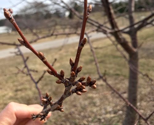
All tree fruits are still dormant. We have not observed any bud swell at the Northwest Michigan Horticulture Research Center. Since Jan. 1, 2022, we have accumulated 35.7 GDD base 42 and 6.2 GDD base 50.
Pest and disease report
With the continued cool weather, we have no reports of insects or disease concerns. Cool and wet weather is favored by the pathogen that causes the bacterial canker disease, so wait for a stretch of warmer and drier weather to prune sweet cherry trees. However, the forecast does not look conducive for pruning sweet cherries until later this month.

