Heat map app allows you to find popular trails and routes when visiting new cities
 Print
Print Email
EmailKeeping active while traveling can be difficult, here is one new, innovative way to get the heart rate up in new places.
Michigan State University Extension works to create healthy lives for Michigan residents by encouraging healthy lifestyles that include physical activity. It can definitely be a challenge to incorporate physical activity into your normal routine, and this challenge is often compounded when traveling. People are often too busy exploring new places, sightseeing or attending work functions to fit in time for a run, bike ride or workout. However, something that I have come to realize in my time traveling for work and/or pleasure is that a run or bike ride is sometimes the best way to explore a new place that you may be unfamiliar with.
While spending some time visiting friends in San Diego recently, I found myself with a few hours to kill one morning. I really wanted to see more of the city by foot, and in the midst of beautiful weather, I decided to take a jog. I was able to see several different neighborhoods, parks and attractions, while also burning calories. It also made me not feel quite so bad about the other way I like to explore new places, which is through eating. The challenging part with running or biking in new places is often finding the best routes or trails to explore.
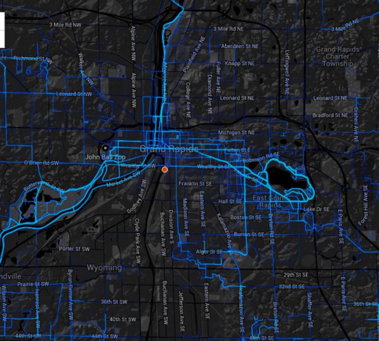
While you may have a favorite running or biking route or trail at home, finding good places to be active while on vacation can be a challenge. If only there was a way to see where the locals go, or find that cool bike path that connects all of the parks in an area. Well that is just what is provided by the Strava Global Heat Maps. Strava is a web- and phone-based GPS tracking application that allows users to track distance, pace and elevation during their running and biking activities. Strava has taken all of the GPS data that their users create during rides, runs, and commutes and mapped it. This allows visitors to see areas of a new place where the highest concentration of running and biking activities is taking place and search them out.
Strava is also using this data to help communities, cities, and entire regions plan for future investments in bike and trail infrastructure. Much of the data that is collected is from Strava user’s bike commutes. By analyzing this data planners can see where a city’s citizens are already traveling by bike the most and develop safer more bike and walking friendly streets. This can also be used to determine where greater bike infrastructure may be necessary in future plans.
For more information on how to stay active while traveling and the best ways to travel healthy visit MSU Extension’s Travel and Tourism Page.