Soil temperatures and planting timing – Part 3 of 3: Testing Enviroweather data
 Print
Print Email
EmailThe Enviroweather network of weather stations provides current and historical weather and soil data for nearly 100 sites within Michigan and northern Wisconsin—but how well do they represent conditions on your farm?
In Part 1 and Part 2 of this series, we looked at how soil temperature is a key factor in determining the optimal time for planting crops and how Michigan State University’s Enviroweather system of weather stations, located throughout Michigan and northern Wisconsin, can be utilized to inform you of current and historic soil temperatures near you. As we all know, air temperatures on your farm are generally the same as those several miles away, but when it comes to precipitation, rain gauges can be very different from one field to the next let alone the next county over. But what about soil temperatures—can those numbers reliably represent conditions several miles away? Can you use soil temperature data from the nearest Enviroweather station to predict those on your farm?
A cursory look at any data set for air and soil temperatures shows the two are closely correlated. This is expected since air temperature, along with other factors like incoming solar radiation, soil moisture and other soil characteristics, determines the temperature of the soil. Therefore, it seems likely soil temperatures would not vary as much as precipitation within a region but would more closely follow air temperatures.
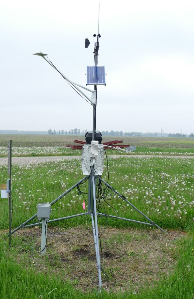
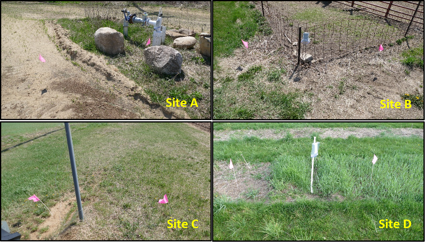 In the spring of 2018 in southwest Michigan, a study was conducted to measure soil temperatures and compare them with a nearby Enviroweather station in Mendon, St. Joseph County. Soil probes were used at each of four locations and at the Mendon station that recorded the high and low temperatures each day. All probes were reading within 1 degree Fahrenheit of each other prior to installation. Probes were placed at 2-inch and 4-inch depths at the Mendon site to correlate with the Enviroweather data, but probes at all other locations were at a 2-inch depth. The pictures and graphs describe the general conditions at each location. Locations were 5, 15, 10, and 9 miles away from the Mendon Enviroweather station for sites A, B, C and D, respectively.
The first two graphs compare temperatures at the Mendon location as measured with the Enviroweather station sensors and the manual probes. Maximum temperatures measured with the probes vary much more than those with the Enviroweather sensors, particularly at 2-inch depth (10 F higher on average). Minimum temperatures were much closer (probes measured 2 F lower on average). Measurements at 4-inch depth were higher with the probes by 4 F on average, but did not tend to vary as widely as at 2-inch depth. As we compare data from other locations, keep in mind the manual probes produced similar, but not identical, results as the station’s sensors.
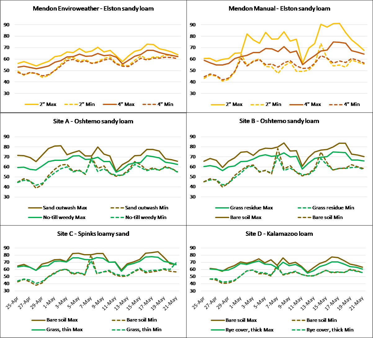
Two probes were placed at each of the other four locations: one under bare soil and the other under vegetation. The maximum temperatures at these sites were 5 F warmer than those measured with the Enviroweather sensors on average, but 5 F cooler than those measured with the probes at the Mendon station. Minimum temperatures were only 2 F cooler than with the Enviroweather sensor and 1 F warmer than with the Mendon probes. Differences can also be seen among the sites, particularly based on soil type.
From this study, it appears the Mendon Enviroweather station temperatures were reasonably close to those at the various locations, particularly the minimums. However, differences did exist, possibly due to the quality and placement of the manual probes. Those wanting to use soil temperature to aid in making planting decisions may want to perform a calibration on their own farms to compare with the nearest Enviroweather station. Temperatures at 4-inch depth were less prone to daily fluctuations as measured with the probes, so it is recommended that the calibration be done at this depth.
If you do not have a temperature probe that records daily highs and lows, take readings at the coolest and warmest times of the day for two to four weeks. This calibration should only need to be done once, but you may want to perform one for each field or soil type. Having access to a reliable, constant source of soil temperature data is extremely helpful, and for those who do not have a monitoring station of their own, the Enviroweather system is a very useful and relevant tool.