Southwest Michigan field crop update – May 28, 2020
Warm air from the south pushes tropical rainfall and armyworm moths into Michigan.
Weather
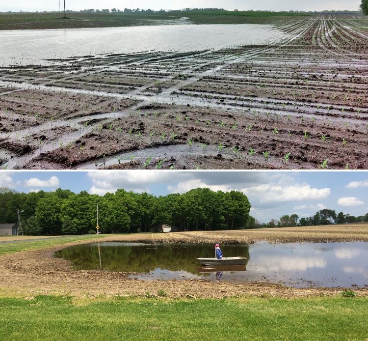
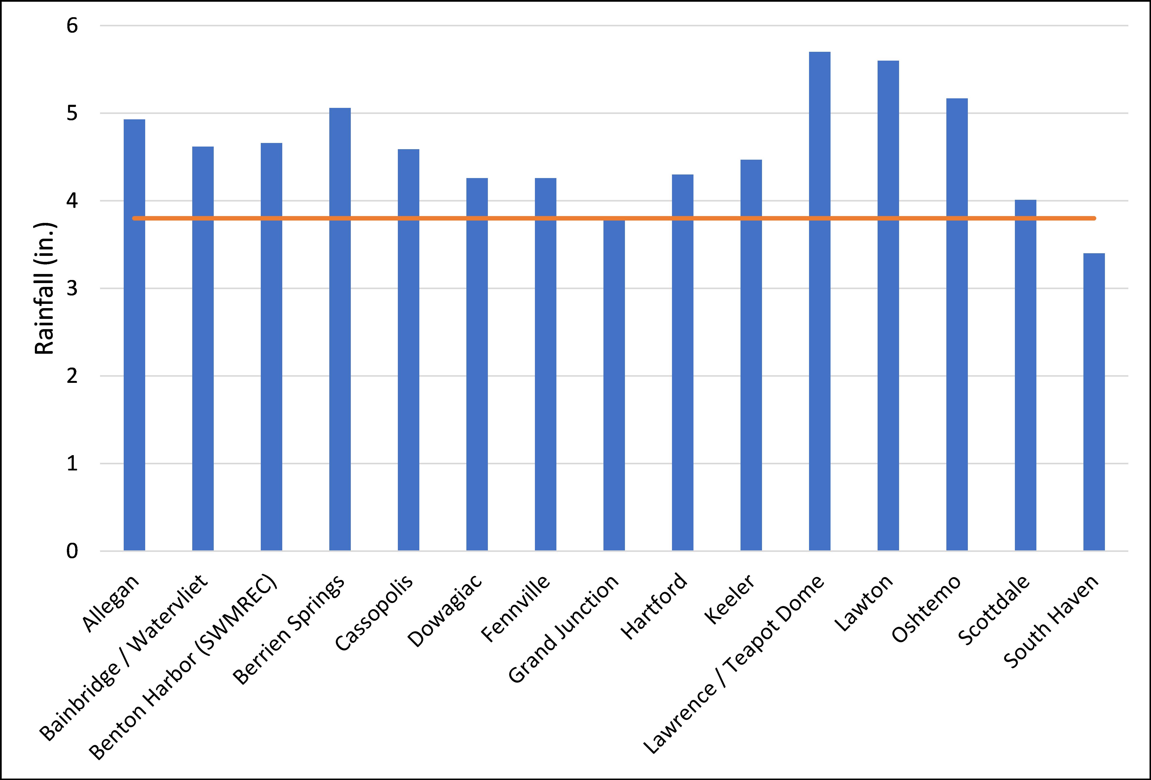
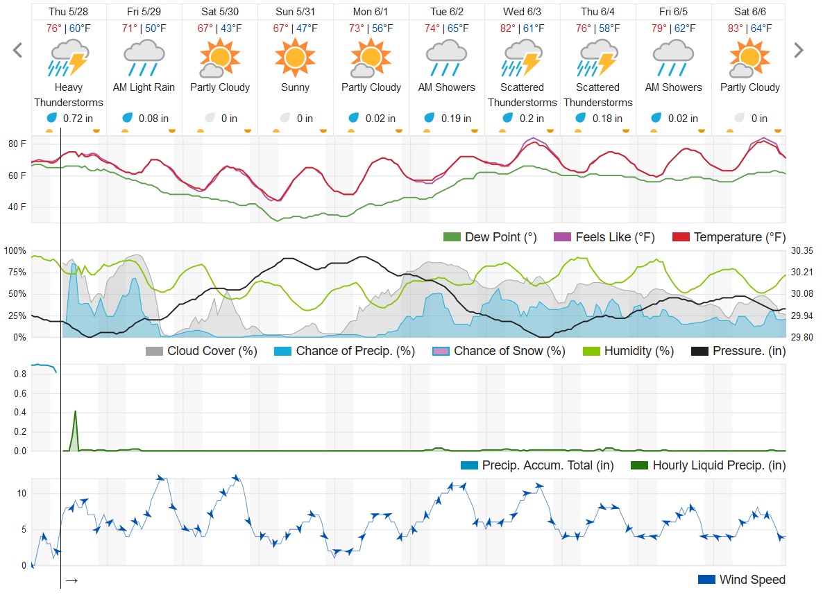
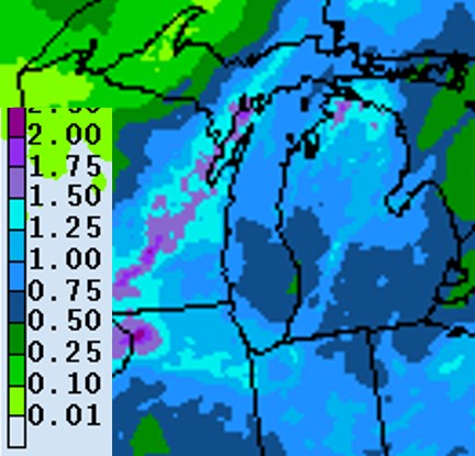
Heavy rainfall put the brakes on field operations across much of southwest Michigan on May 26-27. Many fields that were under the tropical thunderstorms received short duration but extremely intense rainfall, causing erosion on long field slopes and rills on steeper slopes. The extreme warm temperatures can lead to increased risk of flooding injury to submerged crops.
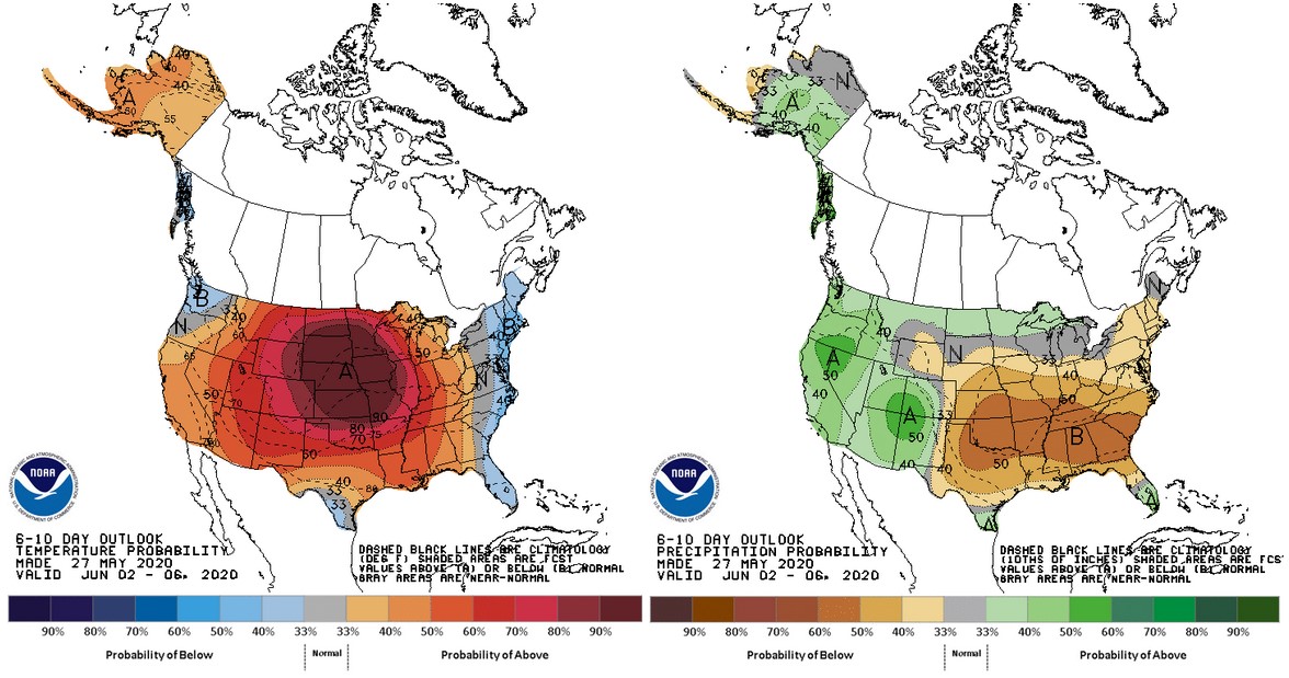
A cold front will be moving through the state May 28-29 with another behind that from Canada that will bring cooler than normal temperatures over the weekend. Temperatures will moderate beginning Monday and will be above normal for the first week of June. Precipitation predictions for the coming week call for only 0.5-1.0 inch with most of that falling before the weekend. The long-lead outlooks call for warmer and wetter than normal conditions for much of the growing season based on mathematical models.
Another concern is the potential leeching loss of nitrate forms of nitrogen. Warm temperatures for several days prior to the heavy rainfall could have kicked conversion of ammonium forms of nitrogen to nitrates in high gear. Heavy rainfall through saturated soils could remove nitrogen, especially on light textured soils. The good news is that there was limited sidedress nitrogen applied, and there is ample time to reapply nitrogen if you think that your early applications were compromised. You can use a pre-sidedress nitrogen test (PSNT) to estimate the potential losses of nitrogen applied early or by mineralized animal manures.

Corn and soybeans
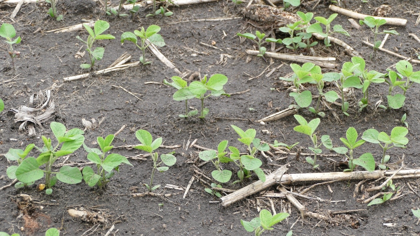
According to the latest USDA Crop Progress report, 70% of the corn and 65% of the soybean in Michigan was planted as of May 24. Corn emergence is at 28% with most fields being at V1 and soybean is at 25% emerged with a wider range of progress from just poking through to near V2. As usual, these numbers are lower than what we are seeing in the southwest.
With the storm systems that started coming through on Tuesday, most activity came to a halt, although a number of planters were still out hoping that the pop-ups would miss them. The front that is making its way through the region Thursday and Friday will bring more widespread rainfall, so most will need to wait until later this weekend or early next week to get into fields again.
Wheat/small grains
Wheat is beginning to head out (Feeke’s 10.5) in the region, although emerged anthers have not yet been observed. Michigan State University Extension wheat specialist Dennis Pennington said he saw a few anthers emerged at their plots in Mason, Michigan, this week, but we are about one to two weeks behind in development due to the cold spring. According to the Crop Progress report, only 4% of Michigan wheat had headed as of May 24.

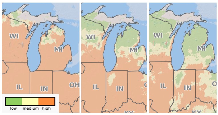
Although some fields are still a week or more away from Feeke’s 10.5.1 (anthers emerged), it is not too early to begin scouting and making plans for a fungicide application for Fusarium head blight, also known as head scab. With the warm and wet weather these past few days, the Fusarium Risk Tool prediction model shows that much of southern Michigan is at moderate to high risk of head scab. Feeke’s 10.5.1—or within seven to 10 days after this—is the ideal time to apply a head scab fungicide. As your wheat approaches this key stage, be sure to check the Fusarium Risk Tool, know your variety’s level of susceptibility, and assess when or whether a fungicide treatment is warranted. MSU Extension field crops educator Bob Battel wrote a recent article summarizing Fusarium head blight fungicide options.
Alfalfa
First cutting has begun in the region, although this week has made it more than challenging to find enough dry days to harvest. MSU agricultural climatologist Jeff Andresen says that late weekend or early next week should provide the next best chances to take first cutting.
Pests
The warm conditions have kicked both crop and weed growth into high gear. Watch weed sizes carefully to make sure the maximum size for control is not exceeded. Soil conditions may be too wet for spraying for several days in the hardest hit areas, especially if the expected rainfall today occurs. The 2020 Weed Control Guide for Field Crops" from MSU Extension has maximum weed heights listed in Table 1H for corn, Table 2H for soybeans.
In addition, the strong push of warm air from the south has brought an influx of armyworm and black cutworm moths into the upper Midwest. Purdue University has reported high numbers of moths caught, and MSU Extension educator Paul Gross caught over 1,000 moths this week with a Hartstack pheromone trap located near Mount Pleasant, Michigan. While these types of traps are very efficient at catching moths compared to the standard bucket trap, it is clear that there are likely to be hotspots for both black cutworms and armyworms across southern Michigan.
MSU field crops entomologist Chris DiFonzo says these moths will be laying eggs now, so start scouting in seven to 10 days for larvae and signs of feeding. Wheat fields need to be scouted; however, corn fields that have had grassy covers that had been burned down or tilled recently are more likely to have issues with armyworms. Fields that have had winter annual weeds until recently are more likely to have black cutworm issues.
Black cutworms are a little trickier to scout for than armyworms. The larvae tend to go underground during the daylight hours. Watch for stands that are going backwards, have signs of clipping or where you see younger corn plants being pulled underground. You may have to check a 2-foot circle around clipped plants to find the larvae. DiFonzo wrote an excellent article that addresses black cutworm scouting.


 Print
Print Email
Email