Coastal Planning and Zoning Course: Lesson 5
DOWNLOADDecember 10, 2021 - Tyler Augst, Michigan State University Extension and Michigan Sea Grant
 Print
Print Email
Email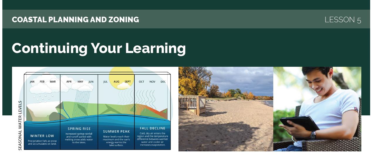
This lesson is one of a 5-part e-mail series on Great Lakes coastal zoning and planning. Register for the complete series online.
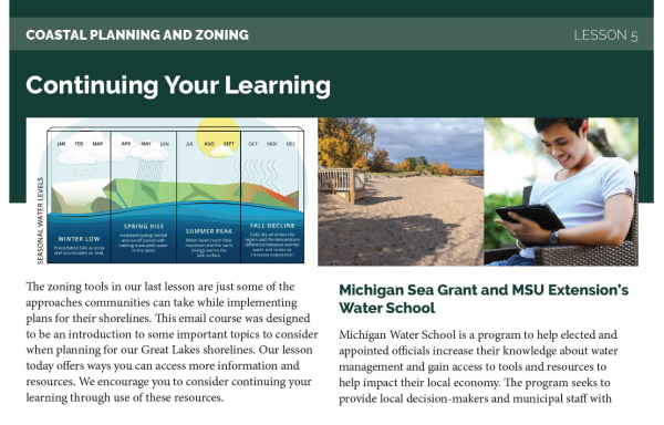
Lesson 5: Continuing your Learning
The zoning tools in our last lesson are just some of the approaches communities can take while implementing plans for their shorelines. This email course was designed to be an introduction to some important topics to consider when planning for our Great Lakes shorelines. Our lesson today offers ways you can access more information and resources. We encourage you to consider continuing your learning through use of these resources.
Michigan Sea Grant and MSU Extension’s Water School
Michigan Water School is a program to help elected and appointed officials increase their knowledge about water management and gain access to tools and resources to help impact their local economy. The program seeks to provide local decision-makers and municipal staff with critical, relevant information needed to understand Michigan’s water resources. Lessons include understanding the fundamentals of water science in order to support sound water management decisions and increase awareness of current and future local and state water issues.
For more information about Water School please visit https://www.canr.msu.edu/water-school or email MIWaters@msu.edu.
MSU Extension’s Citizen Planner Program
The MSU Extension Citizen Planner Program offers land use education for locally appointed and elected planning officials and interested residents throughout Michigan. This non-credit course leads to a certificate of completion awarded by MSU Extension. Advanced training through the Master Citizen Planner (MCP) credential is also available. The Citizen Planner Program is offered in a classroom or via video conference setting, or through a convenient self-paced opportunity called Citizen Planner Online.
For more information on the Citizen Planner Program please visit www.citizenplanner.msu.edu or email CPlanner@msu.edu.
Michigan Department of Environment Great Lakes and Energy
The Michigan Department of Environment, Great Lakes, and Energy (EGLE) is tasked with protecting “Michigan’s environment and public health by managing air, water, land, and energy resources.” EGLE has many programs dealing with water and shoreline issues, such as the Michigan Coastal Zone Management Program. EGLE also often offers events and training on a variety of topics. Several helpful websites from EGLE include:
- Michigan Coastal Management Program
- Michigan's Resilient Coast: Living on the nation's longest freshwater coastline
- Resources compiled by the Michigan Coastal Management Program to help communities create more resilient coasts.
- High Risk Erosion Areas: Programs and Maps
- An overview of EGLE’s High Risk Erosion Area program and maps of these areas by county.
If you have questions about the Michigan Coastal Management Program email Ronda Wuycheck at WuycheckR@michigan.gov.
Building Coastal Resilience Series
This series of six videos introduces viewers to some of the challenges facing Great Lakes coasts and steps communities can take to become more resilient against those challenges. Learn from experts around the state about the impacts of high water, data and tools for making informed decisions, adaptation strategies, and more. Each video is about 10 minutes long and makes a great resource to share with others in your community.
EGLE has compiled all six videos into a playlist on Youtube here.
NOAA Lake Level Viewer and Digital Coast
The Lake Level Viewer is a web-based tool from the National Oceanic Atmospheric Administration (NOAA) that is a great resource for visualizing the impacts of the changing water levels discussed in Lesson 1. For each Great Lake, the tool can create a visual showing lake levels at +/- six feet from the long term average. This can be very useful when planning for your coastal areas or considering revisions to a zoning ordinance.
The NOAA Lake Level Viewer is available online
NOAA’s Digital Coast is a platform to provide coastal communities and managers with data, tools, and training needed. Digital Coast content comes from many different places and covers a variety of topics, but all of it is vetted by NOAA. One of the many tools available are the Coastal County Snapshots that provide useful charts and graphs for complex coastal issues at the county level. The Digital Coasts’ self guided resources are a great way to continue your learning on coastal issues.
The NOAA Digital Coast can be accessed online.
Michigan’s Great Lake Shorelines Throughout Time
The Great Lakes Research Center at Michigan Technological University has created a web based mapping tool that allows users to see the changing Great Lakes shorelines over time. Using data that spans 80 years, users can use this tool to see historical water levels and blufflines overlaid onto satellite imagery. The map also contains oblique photography of the shorelines that give a view of looking at the shore from out above the water. How has the shoreline in your community changed over the past 80 years?
The Michigan Great Lakes Shorelines Throughout Time is available online.
Resilient Great Lakes Coasts
The Resilient Great Lakes Coast program “is a multi-disciplinary research initiative meant to help coastal communities across the State of Michigan enhance their resilience to coastal flooding.” This program led the efforts in scenario-planning for shorelines from Lesson 3. The research team has taken the lessons learned and created this website to guide other communities who want to replicate the process. The site features sources for coastal data as well as technical methodology guides for communities to create and model scenarios for planning.
Funding and financing: Options and considerations for coastal resilience projects
This quick reference guide available through NOAA's Digital Coast provides an overview of different types of funding and financing options for coastal resilience projects. These are presented in NOAA’s Funding and Financing Coastal Resilience virtual training series, where participants learn more about these approaches and how a range of communities have successfully used them.
The Federal Emergency Management Agency has also compiled a guide to assistance resources for federal, state, and nongovernmental hazard mitigation that is available for Michigan and tribal nations.
Great Lakes Coastal Resilience Planning Guide
This is an online hub of best practices, resources, and lessons-learned for building community resilience, as shared by practitioners through an assortment of case studies in the Great Lakes. The planning guide is available online.
Review the lessons from this course
Links for each of the lessons in this email course can be found below and will remain available for you to revisit. Feel free to bookmark or save them and return often.
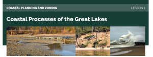
- Lesson 1: Coastal Processes
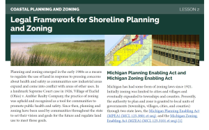
- Lesson 2: Legal Framework
- Lesson 3: Planning for Shorelines
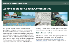
- Lesson 4: Zoning Tools for Shorelines
- Lesson 5: Continuing Your Learning
Thank you for participating in this MSU Extension and Michigan Sea Grant Coastal Planning & Zoning Email course. We hope that you found this short email series helpful as an introduction to some important topics to consider when planning for our Great Lakes shorelines. In a few days you will receive an email with an evaluation survey. We would appreciate any feedback you can give to help us improve this experience. If you have questions or would like more information on any of the materials used in this course please email Tyler Augst, augsttyl@msu.edu.