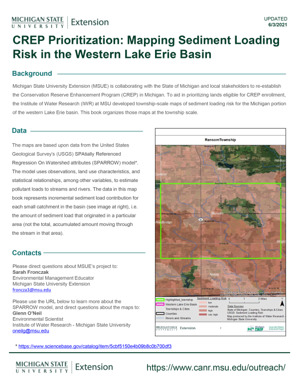
CREP Prioritization: Mapping Sediment Loading Risk in the Western Lake Erie Basin
DOWNLOADJune 3, 2021
 Print
Print Email
EmailMichigan State University Extension (MSUE) is collaborating with the State of Michigan and local stakeholders to re-establish the Conservation Reserve Enhancement Program (CREP) in Michigan. To aid in prioritizing lands eligible for CREP enrollment, the Institute of Water Research (IWR) at MSU developed township-scale maps of sediment loading risk for the Michigan portion of the Western Lake Erie basin. This book organizes those maps at the township scale.